Morgan Moments – Capturing Brigs
Many thanks to Jim Foley for the prompt to publish this article and some additional information about it. Mr. Foley is the Historian for Deal Borough (New Jersey) and is also involved with the Long Branch Historical Museum. Mr. Foley asked about an event, which occurred near Long Branch according to his records, in August 1777.
Even though it wasn’t presented as such in my 3rd grade NJ History class, Raritan Bay, the bay onto which Morgan, New Jersey is situated, was a hot bed of American Revolutionary War actions. During Revolutionary War days, James Morgan, Sr. was a Captain in the Second Regiment Middlesex County militia. Capt. Morgan’s property included the bluffs overlooking Raritan Bay which in the present day includes Morgan Avenue on both sides of NJ State Route 35. From this vantagepoint, at the apex of the triangle making up Raritan Bay, is a complete view the bay spanning from the mouth of the Raritan River and the Arthur Kill – present day South Amboy and Perth Amboy – across Staten Island, across the western portion of Long Island & Coney Island, Sandy Hook, Atlantic Highlands and the entire south shore of Raritan Bay. Everywhere!
It was from somewhere within this property where Capt. Morgan wrote his observations of British movements on the bay for General Washington.
According to Alvia Disbrow Martin in her book, “At the Headwaters of Cheesequake Creek,” Capt. Morgan “… commanded a company of militia which consisted equally, of boatmen from along the shore and farmers from farther inland. Because of this, the militia was able to move equally well on water and land.”
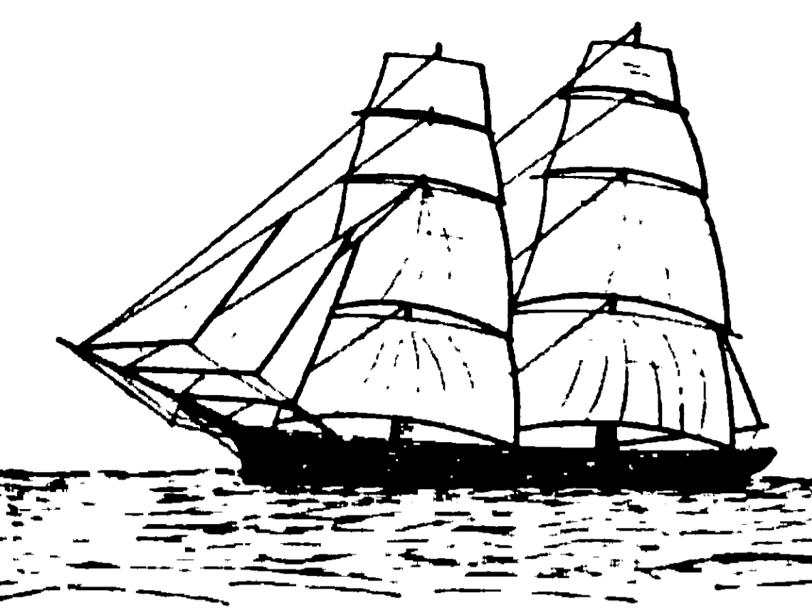
The Brig “William and Anne”
It must have been the boatmen portion of Capt. Morgan’s company that allowed for them to capture a British ship during the summer of 1777 off the coast of Long Branch, NJ. Long Branch, which later became a desired shore destination during the 1870s and 1880s, is just under 19 crow flying miles from Capt. Morgan’s property in present-day Morgan, NJ. In fact, from 1875 until sometime in the 1950s, you could take a train directly from Morgan to Long Branch (now you need to go to South Amboy as Morgan no longer has a train stop)!
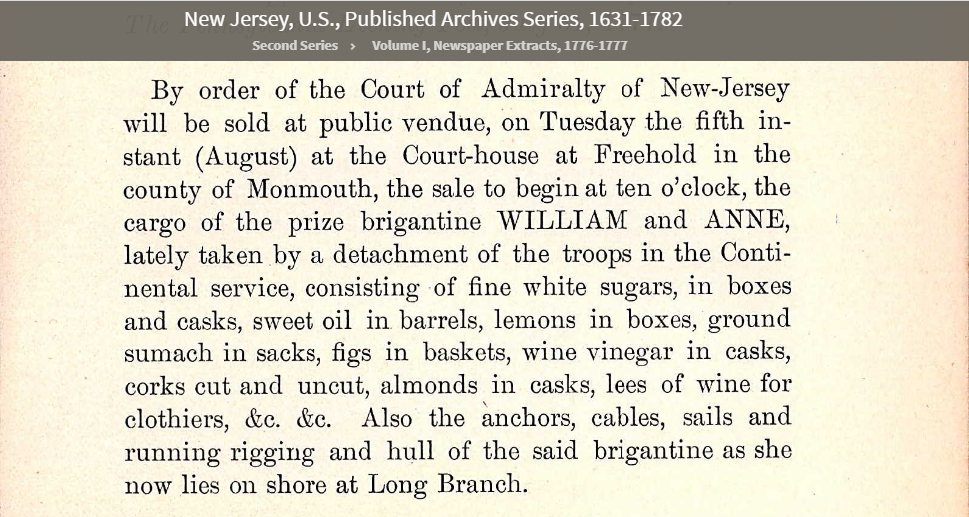
Here is a newspaper entry (name of newspaper is unknown) from July, 1777 discussing the ship captured by Capt. Morgan’s company:
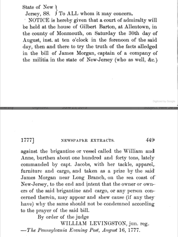
A few weeks later on August 16, 1777, the following appeared in The Pennsylvania Evening Post:
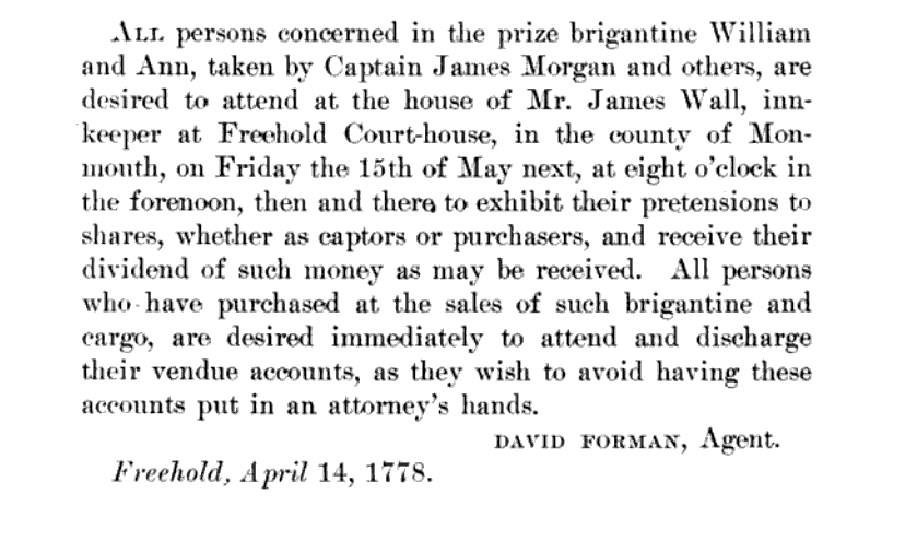
Apparently, the next year, the following notice appeared:
Alvia Disbrow Martin provided some additional information, “Captured ship cargo was usually controlled by the New Jersey Court of Admiralty. Hundreds of these enemy ship seizures were made in the Raritan Bay by Captains Morgan and Hyler, Colonel Asher Holms, William Marriner and others. These boatmen used every inlet off the Raritan Bay at one time or another to their advantage.”
Many Courts of Admiralty held at the house of someone named Gilbert Barton of Allentown, NJ can be seen in this link (click “Next” within the reader).
Allentown, located 10 miles away from Trenton on the west side of New Jersey, seemed a curious location for a Court of Admiralty for events that occurred, at their closest, 30 miles to Raritan Bay or the Atlantic Ocean. The only way to get to Allentown would have been by foot or horse. The Allentown Village Initiative site discusses how Allentown’s location at the intersection of Native America Indian paths and the Lower York Road – the first road across New Jersey which connected the East Jersey capital of Perth Amboy with the West Jersey capital of Burlington – made Allentown the preferred location for Courts of Admiralty. It also gives more insight into the Court of Admiralty and Gilbert Barton.
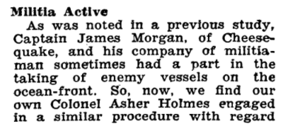
The Brig “Britannia”
Meanwhile, about a year and a half later, right off the bluffs of Capt. Morgan’s property, came another confiscation of another British brig. This time, however – and ironically, it wasn’t captured by Capt. Morgan:
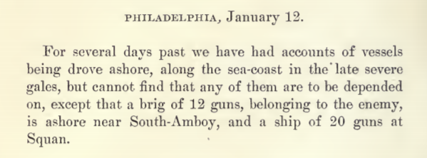
“Squan” means “Manasquan” which is a river and small village located on the Atlantic Ocean 14 miles south of Long Branch, NJ and 30 miles east of Allentown.
The book “This Old Monmouth of Ours” by William Stockton Horner and first published in 1932, discusses many aspects of Revolutionary War activities in the Monmouth County area. In it, there are two sections that reference the capture of the Britannia. The first one contains the following:
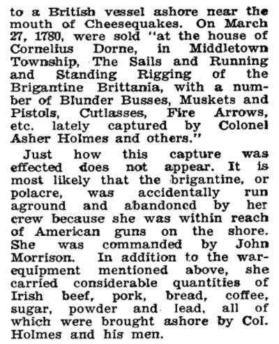
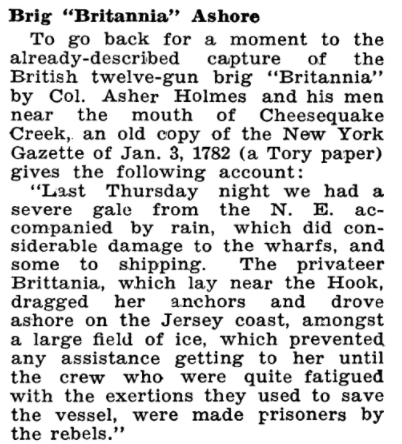
The second reference to the capture of the Britannia, in turn, quotes the New York Gazette from January 3, 1782:
There is a discrepancy in that the January 3, 1782 article identified is dated two years after other articles which are from January 1780.
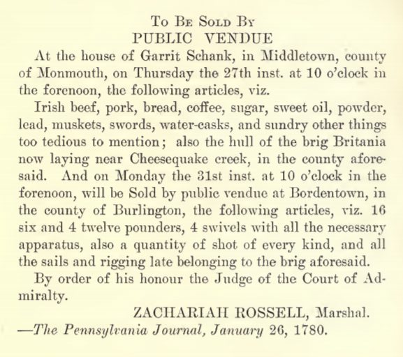
The following notice about the public auction of the captured spoils from the Britannia, originally announced on January 13, 1780, appeared in The Pennsylvania Journal on January 26, 1780. Bordentown is even further away from Raritan Bay than Allentown is. The component being sold there would have had to have been pulled by horses, or oxen, if they used oxen. If they had only waited 51 years, they could have used the newly built Camden and Amboy Railroad. Timing is everything.
The interesting part of this capture is that it wasn’t done by Capt. James Morgan and his band of merry men. It is interesting because, literally, James Morgan’s enormous property holdings were adjacent to Cheesequake Creek and Raritan Bay. You would have been able to see the wreck while standing on the bluffs overlooking the bay on his property.
The July 4, 1976 issue of The Asbury Park Press has an article about the capture of the Britannia which contributes a few additional details not contained in any of the above sources. The newspaper published:
- The size of the ship (it was hard to read and may be slightly inaccurate) was 138-tons.
- The ship had just arrived from England but because it encountered one of New Jersey’s notorious nor’easter storms, it tried to take shelter on the bay side of Sandy Hook.
- The storm blew the ship across the bay with both of its anchors dragging.
- American militia lookouts on the Highlands of Navesink sent word to Col. Asher Holmes of Pleasant Valley.
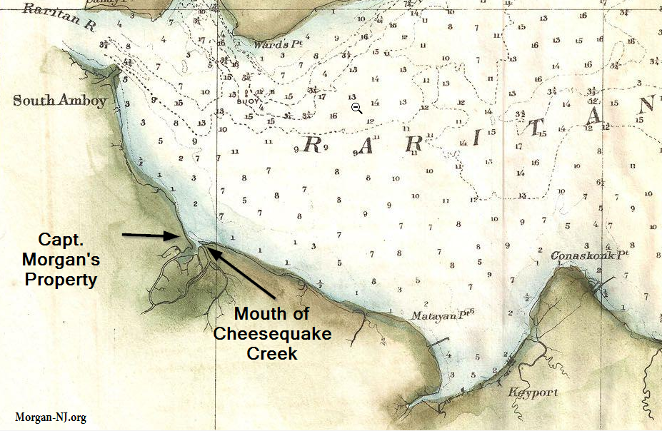
Today there are no remains visible of the brig Britannia. The original mouth of Cheesequake Creek, as seen in the above image, was reconfigured in the 1880s into what we see today.
Originally posted on May, 3, 2021.