The Second “County Bridge” Over Cheesequake Creek. Picture Post Card Courtesy of Joyce Elyea.
Morgan Memories – The Bridges of Cheesequake Creek
When I started this web site, I had no notion of how much of the effort would ultimately surround the topic of Cheesequake Creek. At Morgan’s southern most boundary, Cheesequake Creek has had more influence on Morgan’s history than I had ever known or imagined. Sadly, by the time any of us came into the movie, the creek’s glory days were long gone.
Historically, one of the biggest topics surrounding Cheesequake Creek is trying to traverse it. From the early days of the Old Spye Inn, when people in stage coaches purportedly waited for low tide in order to cross it, getting across Cheesequake Creek presented a challenge.
This posting is specifically about all the various bridges which have crossed Cheesequake Creek since the first bridge crossed it, I believe, some time in the mid to latter part of the 19th century. Both major modes of terrestrial transportation, road and railroad, have had more than one bridge over time over the creek. Presently there are three bridges over Cheesequake Creek, two are for automobiles and one is for trains.
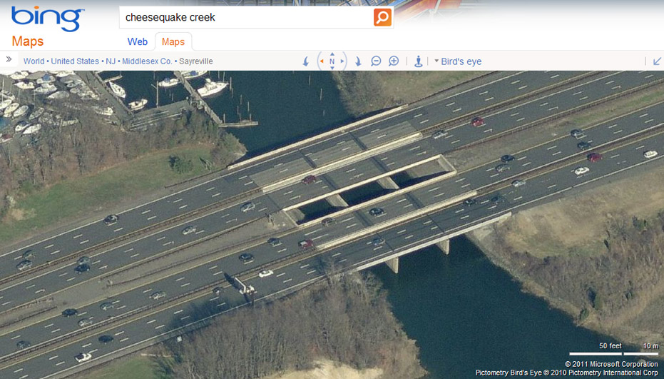
Garden State Parkway Bridges over Cheesequake Creek. Photo Courtesy of Microsoft’s Bing Search Engine and Pictometry International Corp.
The first bridge we’ll cover is the bridge closest to the creek’s headwaters and furthest away from Raritan Bay, the Garden State Parkway (GSP) Bridge. In actuality the Garden State Parkway Bridge is made up of two bridges, one for each direction. IMHO, this is the least interesting bridge to cross the creek – ever! You’ll note that it has been so uninteresting to me that I had never even thought of taking a photo of it until after I originally created this write-up!
Garden State Parkway Bridges over Cheesequake Creek as seen from Morgan Marina in August 2011.
From what I can tell by referencing one of my favorite web sites, HistoricAerials.com, physical construction of the twin GSP bridges started sometime in 1953. Of course this was after the roadbed’s foundation was in place. If you look at the 1953 aerial image on HistoricAerials.com you won’t see the bridges but you will see the extensive roadbed foundation of the GSP spanning the entire width of the creek. You’ll also see barges on the actual creek which appear to be working on the bridge supports. Note that this area was newly dredged for the Parkway. The creek appears to have been redirected to remove one of the creek’s jogs discussed in the early Chief Engineer of the US Army Corps of Engineers Report. Just south (below) the barges, you can see the original path of the creek. In fact you can still see this artifact today. I do not know why they would have gone through the expense of redirecting the creek at that time since by then there wasn’t really any commerce originating from the headwaters of the creek.
The 1954 HistoricAerials.com image shows completion of the two bridges with what appears to be two lanes in each direction. When compared to today’s configuration, which features two six-lane bridges in both directions, the original bridges are located on the outside sides. Note that the portion of the Garden State Parkway just to the north of the Parkway Bridge passes directly through the previous site of the T. A. Gillespie Shell Loading plant and right through the area where the most intensive explosions occurred in October 1918.
The official opening ceremony of the Garden State Parkway was on October 23, 1954 though each section of the Parkway was opened as each section was completed. Undoubtedly, the section over the new bridges and the rest of the Cheesequake Creek basin opened in advance of the official opening ceremony.
In terms of passenger volume, between the three bridges currently in place over Cheesequake Creek, the GSP bridges accommodate the largest numbers of people with approximately 135,000 vehicles traveling over these bridges every business day.
Railroad Bridges
The next bridge we will discuss now is the one which is currently the oldest. In fact, this bridge turned 100 years old in early 2013.
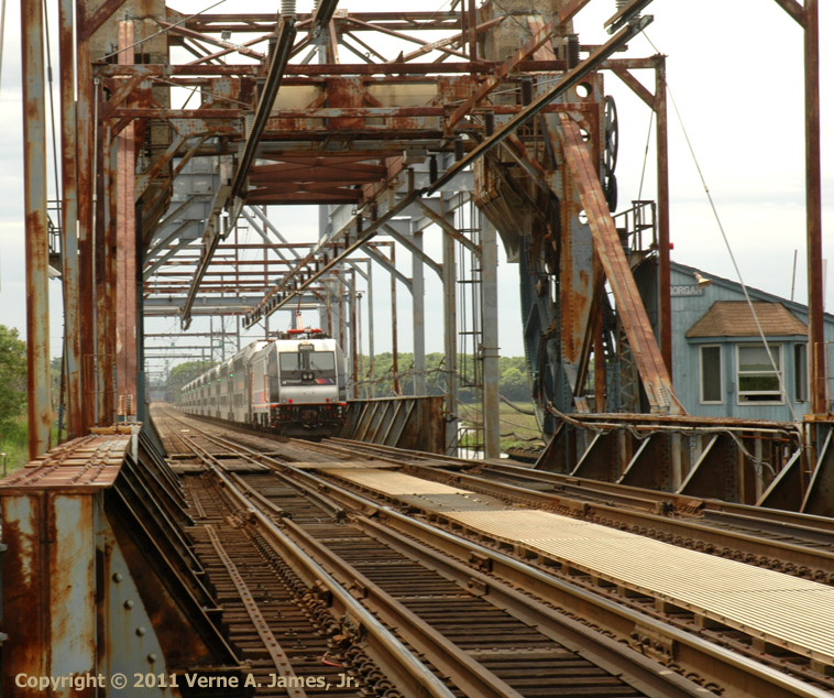
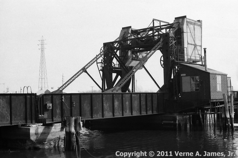
The Current NJ Transit Railroad Bridge Over Cheesequake Creek in May 2008.
Situated just east of where Crossways (or Back) Creek merges with Cheesequake Creek, at the location where Flat Creek and Cheesequake Creek merge, is the present day NJ Transit Sherzer type single leaf rolling lift draw railroad bridge. Unlike the current Route 35 bridge, which is only a hindrance to sailboats, this bridge can be a nightmare to any mariner coming from Morgan Marina, Brown’s Boat Yard or Lockwood Boat Works and heading east toward Raritan Bay. Unless the bridge is in the open position, all but the very smallest of boats are not able to get past it. Additional information on the construction – with references to articles from the South Amboy Citizen Newspaper, electrification and maintenance of this bridge can be seen in this Morgan-NJ.org page
This is the second railroad bridge to occupy this spot. The original 1870’s bridge, which was built for the then named New York and Long Branch Railroad, appears to have been located at exactly the same location as the current bridge and was of a very different type of design.
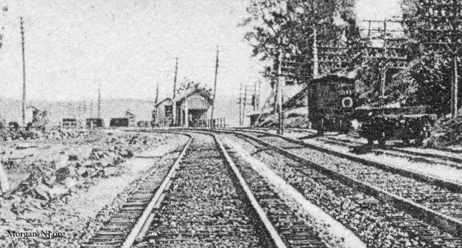
Picture Post Card Close Up of Original Swing Bridge Over Cheesequake Creek and the Morgan Station, Circa 1910.
As shown in the above rare close up from a picture post card from the early 1900s, the original 1870’s bridge was a swing or pivot type of bridge. The three walls of the swing railroad bridge can just barely be seen just to the left of the buildings making up the Morgan Station. It looks like the two railroad tracks pass in between the three walls of the bridge and it also appears as if these walls were made of some type of metal. Iron, maybe? An aerial drawing of this bridge can also be seen in the below image.
Sketch from the 1879 US Army Corps of Engineers Survey of Cheesequake Creek (Dated 1882) Featuring, from Left to Right, the County Road Bridge, the Proposed Dam (Dark Line), and the Railroad Swing (Pivot) Bridge.
The 1880 Report of the Chief Engineer of the US Army Corps of Engineers briefly discusses the then relatively new railroad bridge, as follows:
“… passes the railroad over the creek, has a pivot-draw, with a total span of 126 feet, and 2 openings of 40 feet in the clear. There are 3 masonry piers. The approaches on both sides are trestle-work.”
I don’t yet have any specific info regarding how this specific swing bridge would have been opened in its day but most likely it would have been by hand. There was probably a hand wheel connected by a vertical pole to a small gear which would in turn connect to a large stationary gear at the base of the bridge. The bridge itself would have likely rested on a number of support wheels on a large pivot. The bridge operator would manually turn the hand wheel to open or close the bridge. Here is a 1902 New International Encyclopedia description of how this type of swing bridge would have functioned at that time. While it mentions “steam-engines, gas-engines, electric motors, and hydraulic motors”, I really doubt any of those would have been present on the bridge over Cheesequake Creek in the 1870s. When/if I find out otherwise, I’ll update this posting:
“Swing bridges, in which the opening span swings horizontally on a turntable or vertical pivot carried by the pier supporting the span; …
The most commonly used form of a drawbridge is the swing bridge. Generally the supporting pier, called the pivot pier, is placed under the centre of the span, which is always either a plate girder or a truss span. Sometimes, however, the pivot pier is located nearer to one end of the span than the other, in which case the shorter arm has to be counterweigh ted to balance the longer arm. When a swing bridge is open, the axis of the span is parallel to the axis of the stream; there are two open channels on each side of the centre pier and the ends of the span are swung clear of any support. When the bridge is closed the ends of the span are supported on piers. The longest swinging span ever constructed is that for the Interstate Bridge at Omaha, Neb., which has a total length of 520 feet. The Thames River Drawbridge, New London, Conn., has a swing span of 503 feet, and the Arthur Kill Drawbridge between Staten Island, N. Y., and the New Jersey mainland, has a swing span of 496 1/2 feet. The manner of supporting a swing span on the pivot pier so that movement is possible is quite simple. A casting at the centre of the pier carries a vertical pivot. Around this pivot as a centre is bolted to the pier a circular track having gear-teeth on the outer circumference. To the bottom of the span is attached a circular drum of the same diameter as the track on the pier, and at the centre of this drum is a socket which fits over the pivot on the pier. Between the bottom of the drum and the pier-track is placed a chain of rollers kept in position by radial arms running to the centre pivot. The span swings on these rollers, the centre pivot serving only to hold it in position or true to its centre. Movement is brought about by a vertical shaft running in bearings attached to the outside of the drum and having a gear-wheel at its bottom end which meshes into the gear-teeth on the outside of the fixed pier-track; the rotation of this shaft causes the drum to turn on the rollers and swing the span. In large spans two shafts are employed. The motive powers employed to operate the shafts are steam-engines, gas-engines, electric motors, and hydraulic motors. One modification of the centre pier swing span is the form already mentioned as having the pivot pier nearer to one end than the other; another is where the pivot is at the extreme shore end of the span while the other end is supported by a floating pontoon which swings with the span; another consists of two unequal arm spans with their pivot piers in the opposite banks, and the ends of the long arms meeting and locking over the centre of the channel.”
 The current Sherzer type single leaf rolling lift draw railroad bridge replaced the original swing bridge in early 1913. Further information about the building of the current railroad bridge is contained in this Morgan-NJ.org page. For additional South Amboy Citizen articles specifically relating to the Railroad Bridges, see this same Morgan-NJ.org page.
Road Bridges
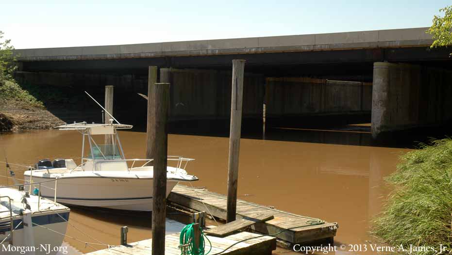
Though it might be the first bridge a mariner encounters when entering Cheesequake Creek from RaritanBay, the current Route 35 draw bridge is not the “first” road bridge to have been located at the mouth of the Cheesequake Creek. It appears in fact to be the fourth road bridge to have been situated at the mouth!
First Bridge – Opened Sometime Prior to 1879
Sketch of the First County Road Bridge from the 1879 US Army Corps of Engineers Survey of Cheesequake Creek (Dated 1882).
A description of what I believe to be the first road bridge across Cheesequake Creek is also contained in the same 1880 US Army Corps of Engineers, Chief of Engineers Report referenced above.
“There are two draw-bridges at the mouth of the creek; one, passing the county road, is about at right angles to the shore-line of the bay. It is a simple pile structure, and the draw is opened by running it parallel with the line of the bridge. It gives about 40 feet in the clear when the draw is open.”
At this time, this is the only information I have on this bridge. No diagrams. No sketches. No other descriptions. As I said in a to-be-reposted page, I don’t know how “running it parallel with the line of the bridge” would have been accomplished in 1879. Maybe one of the readers will be able to provide more info on this.
This same bridge is also referenced on page 13 of a New Jersey law passed during the 1881 session of the One Hundred and Fifth Legislature of the State of New Jersey and Thirty-Seventh Under the New Constitution.
“2. And be it enacted, that the board of chosen of freeholders of the county of Middlesex, are authorized to remove the present bridge across the mouth of Cheesequakes creek, to and across the new channel when the said new channel shall be completed by the United States government.”
It seems like they were thinking of physically moving the first bridge from its original position over the original mouth to span the newly dredged channel. Wonder if that is what actually happened?
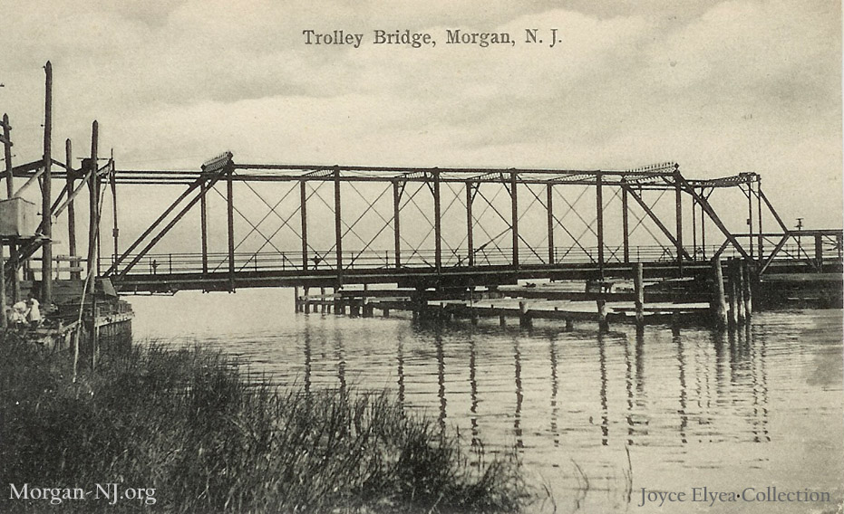
Second Bridge – Opened Circa 1898
This does – forgive this one – bridge us onto our next topic, i.e., the second county road bridge across Cheesequake Creek. This second bridge, which is shown on a picture post card at the very top of this Morgan-NJ.org web page, appears to have a classically Victorian era design (at least it seems so to me). According to the September 21, 1912 issue of the South Amboy Citizen, this “draw was erected fourteen years ago” which would put it at 1898. While I don’t have much in the way of other information at this point regarding this classically elegant bridge, it was a swing/pivot type of bridge. The Citizen article goes on to say:
“When the draw was erected fourteen years ago no one dreamed of the traffic it would be burdened with. At that time a half dozen wagons a day would be considered a rush, but now the travel over it by autos and wagons is continuous night and day. The old bridge is entirely inadequate to the traffic, and has become entirely worn out.”
The full text of this article, and many others relating to the various bridges of Cheesequake Creek, are shown in full with links provided further down in this posting. One of the articles states that this bridge was opened by hand! All of these South Amboy Citizen articles have been made available to all of us courtesy of South Amboy’s Sadie Pope Dowdell Library web site.
This bridge, built with horses in mind, was modified some time in the early 20th Century, circa 1904/1905, to accommodate trolleys of the Jersey Central Traction Company. It isn’t clear whether the structure of the bridge was reinforced but certainly the overhead centenary wires would have had to have been installed along with a means of allowing for the bridge to still swing open and closed.
Third Bridge – Opened September 15, 1913
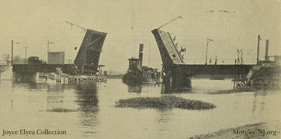
The Third “County Bridge” Over Cheesequake Creek. Picture Post Card Courtesy of Joyce Elyea.
Interestingly enough, while the abutment remains of this bridge and its southern approach road can still be seen on the bay side of the current Route 35 draw bridge, and my mother still speaks of how the first thing she would do when her family arrived at Morgan Beach from the city was to cross it to see her friend Betty Cady, the first time I ever saw a photo of this bridge was in late 2010!
This third bridge over Cheesequake Creek was a significantly different design than the bridge it replaced. Instead of a swing (pivot) type of bridge, the design type selected for this third “County Bridge” was a double leaf bascule draw bridge.
The South Amboy Citizen had a number of articles about this bridge. Some of them discuss the accidental deaths of a few of the men who helped build the now long gone and nearly forgotten structure. For a few decades, this bridge adequately served its purpose of connecting Laurence Harbor to South Amboy via Morgan. From the time the bridge opened in 1913 until the Pratt Truss road bridge was built over the railroad tracks in 1924 (see to-be-reloaded page), there was a sharp turn onto what is now Old Spye Road (see to-be-reloaded page). From 1924 until this third country road bridge was replaced, the road climbed a man made hill in order to cross on the truss bridge over the railroad tracks to then cut across the “Morgan Heights” neighborhood (later my neighborhood).
Mr. Jack Jeandron, is the author of the excellent book “Keyport From Plantation to Center of Commerce and Industry”, and along with his terrific wife, is one of the key members of the Keyport Historical Society and Keyport’s Steamboat Dock Museum (which received significant damage from 2012’s Hurricane Sandy). In my visit there during the summer of 2009, Mr. Jeandron recalled for me how this third Cheesequake Creek road bridge “used to be a draw bridge which sometimes required the car passengers to get out of their cars and jump up and down on the bridge in order for it to fully close!” Can you image that today?
This same bridge was purported to have played an interesting role during Prohibition days. The stories tell of Rum Runners who used to zoom into the Cheesequake Creek tributaries with their cargo of illegal alcoholic products sometimes while in hot pursuit by the Coast Guard (Revenue Service?). The Rum Runner’s high speed boats would acquire the then illegal cargo from a ship somewhere in Raritan Bay or the Atlantic. The pursuing Government boats would lose them as these boats were too large to fit under the two Cheesequake Creek bridges (road and railroad). The Rum Runners would easily zoom under the bridges and the Government boats wouldn’t be able to pursue them further until the bridges opened up.
My Jesse Selover Elementary School and Sayreville War Memorial High School friend Frank was told by his father about underwater nets placed in Cheesequake Creek during Prohibition used to retrieve the hooch which was tossed out by the Rum Runners to sink.
A side view of this bridge can be seen in the to-be-reloaded page about the Robert E. Lee Inn / Cady’s House of Sea Food. To see a beautiful circa 1914 photo of the top of this bridge next to a Jersey Central Traction trolley, see page 13 of the excellent book “Street Cars of New Jersey – Atlantic Coast” by Mr. Joseph F. Eid, Jr.
Mr. John Luhrs told me that this bridge was physically removed by iron workers who also worked for his father’s company, Morgan Yacht Basin, during World War II.
Fourth Bridge – Opened First Week of October 1943
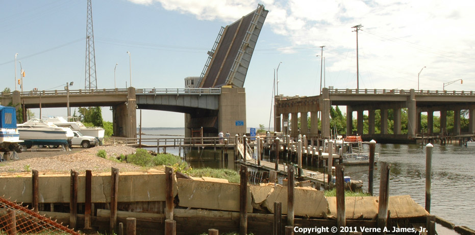
The Current Route 35 “Morgan Bridge” Over Cheesequake Creek, 2009.
Last but not least is the current Route 35 single leaf bascule draw bridge. In the days leading up to World War II, forward looking War planners had determined that the then current draw bridge over Cheesequake Creek was not going to be able to adequately support the Army and Navy’s expected transportation needs in case of war (see the South Amboy Citizen article from October 4, 1940 below). Three years later, directly in the middle of the US involvement in World War II, the new bridge opened. Not only was it again a somewhat different type of bridge compared to its predecessors, it was also much higher which thus allowed for most power boats to pass underneath it without having to open it. This came in handy for my dad when he had to take his Coast Guard boat to Henry Luhrs’ Morgan Yacht Basin, which was located between the two bridges, for service during the war.
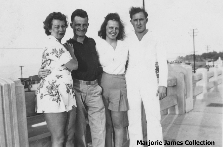
My Aunt Anita, Uncle Ed (Mom’s Brother), Mother and Father on the Relatively New Morgan Bridge Over Cheesequake Creek, Circa 1946.
This bridge is discussed in one of the early Morgan-NJ.org to-be-reposted postings.
This current bridge is the one I have known all my life as “Morgan Bridge”.
South Amboy Citizen Articles Relating to the Various Road Bridges:
December 23, 1911 – BIDS ON BRIDGE ARE TOO HIGH
Bids were received at an adjourned meeting of the Board of Freeholders on Monday for the erection of a new bridge over Cheesequake creek, at Morgan. Three different sets of plans were bid on, and after being received were referred to the road committee.
The following were the bids:
Owega Bridge Co., Owega, N. Y. —
For swinging bridge, $43,866;
For Scherzer lift bridge, $47,977.
F. R. Long Co., Hackensack —
For swinging bridge, $45,125;
For Bascule bridge, $46,603;
For Scherzer, $44,900.
General Contracting and Engineering Co., New York —
For Scherzer lift bridge, $47,856;
Bascule bridge, $47,857 and $55,155;
Swinging, $55,496.
Snare & Triest, New York —
Swinging, $54,300;
Scherzer, $55,900;
Bascule, $57,300.
All the bids exceeded the estimate made by the board, and it is likely they will be rejected.
April 20, 1914 – WORK SOON TO BEGIN ON MORGAN BRIDGE
Now that Vice-President Brown, of the Jersey Central Traction Company, has arrived home from the South, where he has been overseeing the building of a new trolley line, it is expected that work will soon be commenced on the new bridge over Cheesequake creek at Morgan.
The contractors and the Board of Freeholders are both very anxious to have the work started, but before doing so it was necessary that certain agreements be signed by the traction company in order that the company could be held to certain payments on the work. The company under its franchise will have to pay half the expense of the new bridge.
The work cannot be commenced too soon as the present structure is in an unsafe condition. The easterly abutment is in very bad shape, and piling had to be driven to prevent it from falling down.
If it is desired that the Board of Freeholders change the road so as to avoid the dangerous grade crossing over the New, York and Long Branch Railroad, the realty company through whose land it is proposed to run the road had better submit to the board’s plans, or said route will not be changed.
Also in this newspaper issue is an announcement about the “Sinking of the Steamship Titanic”.
The contractors of the new county bridge at Morgan now show signs of getting busy. A work house has been erected convenient to the bridge.
On Wednesday night the draw of the county bridge at Morgan was moved by the Owego Bridge Company to the temporary structure erected to be used while a new lift bridge is being constructed.
The transfer was made by the use of two scows as pontoons. The old draw was previously strengthened by under pinning it with huge timbers, so that in its weakened condition there would not be any liability of its breaking in two. At low water the scows were moved under the draw one each side of the abutment, and then long and heavy pieces of timber were placed so that the ends running across the center pier reached each scow. Blocks were placed from these timbers to the draw and wedged tight. When the tide raised the draw was lifted and the scows with their burden were allowed to drift to the temporary bridge. The Iron cradle of the draw was then removed and securely fastened to the centcr pier. As the tide began to recede the draw dropped in its proper place.
All boat traffic was stopped for the night, but on Thursday the draw could be turned and water traffic was resumed. Trolley passengers were transferred afoot over the structure, but automobiles were compelled to take the Cheesequake road in order to reach Keyport. It is expected that by this Friday night, traffic will again be resumed over the creek.
A number of people from this city witnessed the transfer, among whom was Freeholder Korr, who was present to look after the county’s interest.
When the draw was erected fourteen years ago no one dreamed of the traffic it would be burdened with At that time a half dozen wagons a day would be considered a rush, but now the travel over it by autos and wagons is continuous night and day. The old bridge is entirely inadequate to the traffic, and has become entirely worn out. The freeholders did not decide on a new bridge any too soon, and it has been miraculous that the old structure has not collapsed from the heavy loads that travel over it. The work of clearing away the debre of the structure is now under way, and soon the concrete mixer will be busy on the foundation of the new bridge, and probably by the first of February it will be completed.
Sub-contractors are at work building the concrete abutments for the new county bridge at Morgan. It is stated that the New York and Long Branch railroad will commence work shortly on their new four-track bridge over the creek.
The contractor who has charge of the excavation for the easterly abutment of the new county bridge across Cheesequake creek should desist at once the emptying of surplus dirt along the bank of the creek where the tide as it ebbs and flows carries tons of it into the channel of the creek, and it will be only a short time when all so dumped will be at the bottom of the creek and lessen the depth of the water. Efforts are being made to deepen this creek by government appropriations, and no contractor should be allowed to undo what the government has already done.
Work on the new county bridge at Morgan would seem to progress slowy. The robins will return ere its completion, unless faster progress is made.
The work on the New York and Long Branch, draw bridge at Morgan is progressing rapidly, but the progress on the county draw is very slow.
Work on the county bridge over Cheesequake Creek has been delayed over a dispute with a water bill presented by the Jersey Central Realty Company to the contractors. It is claimed the bill is too much, and efforts are being made for adjustment.
Steel for the new county bridge in Morgan is expected to arrive next week, and then work will progress with a rush.
July 12, 1913 – PROMISE TO COMPLETE BRIDGE IN FIVE WEEKS
The contractors on the Cheesequake creek bridge have promised to complete the new bridge within five weeks or pay a penalty of $25 a day, for every day extended over that time. This agreement was reached at a meeting of the Board of Freeholders on Thursday, at which the matter of taking the contract out of the hands of the Owego Bridge Company was discussed.
The delays of the contractors in building county bridges have given the Board of Freeholders no little concern and annoyance. Both the Woodbridge and Cheesequake creek bridges have been time usurpers, creating much public complaint. Owing to the fact that travel has to be taken care of there may be some excuse for delay on the Woodbridge creek bridge. On the other hand, there is no valid reason whatever for the delay on the Cheesequake creek bridge. The temporary bridge has taken care of the travel, and the contractors have not had any obstructions to delay them, but clear sailing all through and they cannot present any excuse for the delay. They should be brought to [Fines?]. Patience has ceased to be [virtue?] with the Board and they propose taking drastic action against the contractors. In this they will be supported by the public. This bridge could have been finished six months ago, if the contractors had pushed the work.
July 19, 1913 – CONTRACTORS REALLY GETTING BUSY
Since the last “jacking up” by the Board of Freeholders, the contractors on the Cheesequake bridge seem to have really gotten busy and it now looks as though this work will be completed by fall. The contractor for grading and widening the approach has also started work, and has several teams filling in the causeway
August 9, 1913 – Steamer Collins Gets Stays Caught in Bridge
The freight and passenger steamer John B. Collins is having its troubles at the new county draw bridge at Morgan station. On Sunday, when coming down the creek the stays of the masthead were caught in the draw and considerable damage was done. On the following night the tug “Marion” left a scow filled with ballast near the bridge in a manner to interfere with the “Collins” again and a similar accident occurred;.Captain Collins claims that the bridge is not properly built in regard to the raising of the draw, and has reported the matter to the War Department.
Coming into contact with a stay wire charged with 6600 volts of electricity, William Webber was instantly killed at Morgan on Wednesday, while John Webber and John Parker, who went to his assitance, met with severe injuries. Only for the very strong condition of John Weber’s heart, his injuries would have proved fatal.
The accident occurred about 3 o’clock in the afternoon. William Webber, who was employed as a teamster by Michael Welsh, was hurrying toward the temporary county drawbridge, which had caught fire. He stepped on a support wire which had been accidentally charged with electricity, and with a loud outcry he wan seen rolling over the embankment. of sand which had recently been placed there to fill in the approach to the new bridge. In falling he grabbed the wire with his hands. Not. thinking of any danger, and supposing that William Webber, had injured himself in falling, John Webber, who was working a scoop at tbe scene of the accident, ran to his assistance and grabbing William by the wrists, his body also became a conductor for the electricity and he fell unconscious. John Parker, an iron worker for the OwegoBridge Company, who was working on the new county bridge, received several very bad burns about the arms and wrists when endeavoring to rescue the men, and get the deadly wire out of contact with them.
Hundreds rushed to the scene, among them Drs. E. Eulner and E. A, Meacham. No hopes were given for William Webber’s recovery, but by energetically working with John Webber, he regained consciousness and was taken to his home on Augusta street, in this city, later in the afternoon. He is still suffering greatly from the shock and is under the attendance of Dr. Eulner who says but for his strong physical condition, recovery would be impossible.
The body of John Webber was brought to this city in the automobile of J. J. Scully and after the arrival of Coroner Morgan, was removed to Stillwell & Mason’s morgue. On Thursday Undertaker Arrowsmith of Matawan took the body to the home of Webber’s brother at that place.
John Parker, the iron worker who was injured, received medical attendance at his boarding place at Morgan, and from latest reports is getting along nicely.
The deadly wire proved to be a loose support wire which, coming into contact with the main feed wire of the Middlesex & Monmouth E. L. H. & P. Co. rubbed off the insulation and became charged with 6,600 volts of electricity.
The victim of the unfortunate accident was no relation to John Webber, who was so seriously injured in going to his assistance.
Mr. Webber was employed as a diver by Michael Welsh and has two brothers and two sisters who reside at Matawan. The funeral took place at Matawan Friday afternoon.
August 9, 1913 – Lock-Jaw Set In.
John Parker an iron worker, who was so seriously burned by electricity at Morgan last week while trying to rescue the late William Webber is now in very serious condition, lockjaw having set in. On advice of his physician, Dr. Hardman, of Keyport, Mr. Parker was taken to the Monmouth Memorial Hospital at Long Branch on Thursday morning. His recovery is doubtful.
It is said that in removing the temporary railroad bridge over the Cheesequake creek at Morgan, many spiling were broken off. At low tide the ragged pieces of piling left can be seen sticking up in defiance of row or motor boats that might land on them. Motor boat owners are indignant that such dangerous objects should be left. Sooner or later some boat will strike them, and receive damage that may result in its sinking.
August 23, 1913 – A COMMENDABLE ACT.
The friends of the late John Parker on learning of his death, and knowing that he left two little children, aged 3 and 5 years, penniless, started a subscription toward his burial expenses and to relieve the children over the tide of dire necessity. The people responded liberally, and $131.75 was collected. For this commendable work credit is due to Henry M. Kline, of Perth Amboy, who collected $35.00 from the Morgan Beach colony; Edwin Furman, who collected $31.25; Mrs. Dora Ginter, .$3,00; and William Dalrymple, $62.50 from the people at large.
John Parker an Iron worker, who was so seriously burned by electricity at Morgan last week while trying to rescue the late William Webber, is now in a very serious condition, lockjaw having set in. On advice of his physician, Dr. Hardman, of Keyport, Mr. Parker was taken to the MonmouthMemorialHospital at Long Branch on Thursday morning. His recovery is doubtful.
John Parker, an iron worker, who was taken from Morgan to the Monmouth Memorial Hospital at Long Branch suffering with lockjaw, died at the hospital on Friday night of last week. This makes the second death due to the touching of a live wire at the county bridge at Morgan.
It is expected that the new county bridge at Morgan will be thrown open to travel to-day or to-morrow.
The new county bridge at Morgan was opened to traffic last Monday [9/15/1913]. The trolley company has not connected their tracks as yet, but expect to be running over it in a few days.
On Tuesday [9/23/1913] the Jersey Central Trolley cars began running over the new county bridge at Morgan.
The temporary bridge over Cheesequake creek at Morgan is being removed this week.
November 8, 1913 – New County Bridge – Ornament to Morgan
One of the most prominent improvements made by the Board of Freeholders the past year is at Morgan. People from not only this State, but from other States as well, will appreciate the new bridge erected there, and the approaches thereto. The bridge is an ornament to the place. It is of steel, double lift draw, and much wider than the old bridge so that wagon and automobile traffic and trolley cars will not be delayed in passing over it. There is a walk for those on foot, and the danger that formerly existed of being run down by autos, or cars is thus eliminated. Electricity is used for the motive power in lifting the bridge. Each side of the road from the railroad to a point south of the bridge has been fenced, and the railings and posts painted white. The whole thing makes a neat improvement.
The bridge tenders are receiving instructions in operating the draw, and the Board will probably complete arrangements this week for accepting the bridge from from the contractors.
November 15, 1913 – COUNTY BRIDGE ACCEPTED
Having received the approval of the War Department on the bridge over Cheesequake creek at Morgan, the Board of Freeholders on Friday formally accepted the bridge from the contractors, the Owego Bridge Company. The county bridge tenders are now in charge.
Morgan Lambertson is building a house on the county bridge at Morgan for the accommodation of the tenders.
October 4, 1940 – Hearing Will be Held On Proposed Morgan Bridge
Set Date As October 22 At the Laurence Harbor Fire House
A hearing on plans for the erection of a new bridge over Cheesequake Creek at Morgan will take place at 10:30 A.M. Tuesday, October 23 in the Laurence Harbor firehouse, when representatives of the War Department will consider the plication of the state highway department for approval of the structure.
The proposed bridge will be a high level structure about fifty feet south of the existing bridge. Plans call for the removal of the present bridge upon the completion of the new one. Also included in the project is the relocation of Stump Creek, further west to order to provide space for the erection of suans for the new bridge, and the digging of a channel between the present bridge and the New York and Long Branch railroad bridge. The channel will be 8OO feet in length, fifty feet wide and 5.4 feet deep at mean low water.
This week the new bridge spanning Cheesequake Creek on Route 35 at Morgan was opened to better serve Army and Nary units on New Jersey’s seacoast.
The patched-up old span necessarily continued in service with uncertainties regarding its continued safety in the transportation of heavy military equipment will be barred from further use. By-passed also will be the steep grade to the creek, a factor in several drownings when passenger cars crashed the open draw.
The improvement represents an expenditure of $1,406,061. The $924,893 bridge contract is with the Fedhaber Pile Company of New York, and the roadway approaches costing $481,168 are being paved by the Weldon Contracting Company of Westfield.
The new bridge of steel and concrete is 700 feet long. It has two 32-foot roadways on each side of a four-foot safety island and sidewalks of six feet. The lift span is 50 feet wide, but its 25-foot elevation over the creek will permit a greater percentage of boats to pass without halting highway users.
As a safeguard, however, James L. Hays of Trenton, Highway Department electrical engineer, has an auxiliary engine ready to provide power in the event of any failure of electrical equipment.
War restrictions have prevented the completion of an adjacent southbound overpass at the Central Railroad and two-way traffic will continue temporarily on the present railroad overpass.
The concrete foundations have been set for full roadway width at the railroad but the deck cannot be built until the Federal Government releases the necessary materials.
John M. Willet of 142 Grove Street, who has been bridge tender at the creek since 1909, estimates the higher level crossing will reduce by more than 75 per cent the delays for both boats and highway traffic.
At first he turned the bridge by hand, but the reconstruction in 1912 by Middlesex County and the old trolley company, power machinery was installed. Since the state obtained its jurisdiction in 1920 the growth in travel to the seashore resorts taxed the bridge beyond its rated capacity and continuous repairs have been made to prevent its total collapse.
Many of the victims of the smash-ups at the old, narrow crossing were given first aid by Mr.Willett, and he was recently awarded the Highway Department Certificate of Merit for rescuing from drowning four occupants of an automobile that crashed the bridge when it was being opened for a passing boat.
Originally posted on February 23, 2010.
I was born and raised on Morgan beach I lived on the beach from 1942 until a hurricane washed most of it away in the late 1940’s. My great aunt Catherine ruane owned a general store there until same hurrica I would like to find pictures of Morgan beach in that time frame if you can help please let me know
Hi Don! I responded to you via MorganNewJersey@gmail.com. I look forward to hearing from you!
Verne
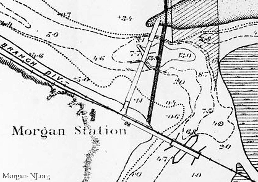
Originally, the mouth of the Cheesequake was an “S” curved meander to the west of the present mouth. A sand bar at the mouth interfered with navigation.
Some time around the 1880’s, the Department of War had the mouth straightened and the “rock piles” installed. An earthen dam was placed adjacent to the new mouth to block the old stream. The rest of the old section of stream then allowed to fill, either artificially or naturally.
Navigation charts (maps) of the time show the work in progress.
Go to http:// maps.ngdc.noaa.gov/viewers/bathymetry/
Zoom in to the Cheesequake area and locate map H01712. A tiff may be downloaded for viewing.
I GREW UP IN morgan On haussling place, across the highway 35 from club bene. I FOUND THE BRIDGES COOL SINCE MY FATER WAS A BRIDGE TENDOR ON THEM FOT MANY YEARS. BACK IN THE 60S WALKED THE MORGAN DRAW BRIDGE COUNTLESS TIMES TO GET TO THE BEACH. GREAT MOMORIES.
Anyone remember the pink house jusr north of the draw bridge. I grew upjust behind mollys diner and next door to ryans sonoco gas station where my brothef mike worked my last name I s teliszesski
Would you happen to know where the E>R> Rose clay pit in the Morgan Creek area was located. I came across it somewhere
but can’t seem to find it again. I know it doesn’t exist today, I was just wondering where it was located. Thanks
There appear to be two “E.R.Rose & Son Stoneware Clay” pits shown on an 1877 map. The eastern one seems to be around the area between present day Martha Blvd and the Garden State Parkway. The other one (western one) looks to be around where Kenneth Ave bends toward the north off of Bordentown Avenue – about 1/3 of the distance between the railroad track and where Bordentown Avenue intersected Route 9 when they actually intersected (before the current configuration where Bordentown curves around and under Hwy 9). Hope that helps! BTW, that’s why the original Route 9 and Bordentown Ave intersection was called “Rose’s Corner” (the picture post card of which sold for over $100 a few years ago on EBay).
I knew Rose’s Corner might have had something to do with E.R. Rose, but could’t find anything specific.
Thanks for the info.. I’m a Sayreville native, but disn’t realise how many clay pits and pottery makers
there were in Sayreville (born 1942). Again, thanks. You are helpful to many ith questions about the area and your
help is appreciated. thanks again,Stephen