Morgan Maps – The New York / New Jersey Raritan Bay Boundary Commission
 On April 20, 1886, a law was passed in New Jersey authorizing the governor to appoint three commissioners to coordinate with three commissioners from New York “to locate and mark out the boundary line between the state of New Jersey and the state of New York in Raritan Bay.” Similarly, on March 15, 1887 a law was passed in New York allowing for the NY governor to appoint three commissioners to coordinate with the NJ commissioners to “locate and mark out, by proper monuments and buoys, the true boundary line between the two states in lands under water in Raritan Bay.”
So began an effort, which was to culminate within 30 weeks time, well within the one year time frame requested, resulting with the definition and identification both on paper and on water of today’s Raritan Bay boundaries. Six commissioners were quickly appointed and they went quickly to work.
The previous definition of the boundary line between NJ and NY dated back to 1834. It was a somewhat vague definition and the lack of visual markings from which to be able to identify it – especially while on the water – proved to be insufficient to the needs as time marched on. As per the New Jersey Joint Resolution, “Whereas, Disputes are constantly arising between citizens of the state and citizens of the state of New York engaged in the shell fisheries in Raritan bay, as [to] the boundary line between the two states in lands under water of said Raritan bay”.
The 1887 Joint Boundary Commission report greatly expands on the issues regarding the boundary between New Jersey and New York:
…it may be well to state the causes that led to the enactment of the laws under which the Commissions were created.
The great value of the lands under water in Raritan bay for the cultivation of oysters became apparent early in the present century. The long, shallow, land-locked bay, subject to the constant ebb and flow of ocean tides and fed by many fresh-water streams, possessed every requisite necessary for the successful and profitable cultivation of every variety of shell-fish. The salt water was their natural element; the fresh-water streams brought an abundance of animal and vegetable life necessary for their growth and development, and the hard, sandy bottom of the bay afforded a bed upon which they could be planted with security.
Beds of natural growth, where oysters grew in great abundance, were found by the first settlers, and for a long time these proved sufficient to satisfy the wants of the scanty population. But the increasing demand resulting from the rapid growth of population in the interior, and the consequent danger of depletion and exhaustion of the natural beds from over-fishing, rendered some method of artificial propagation imperative, and about 1810 oysters were first planted and cultivated. At first, all the lands under water in the bay were considered as common to the residents of both States, and no attempt was made to divide them according to State lines. Only when the industry began to grow in importance, and the lands, consequently, to increase in value, did local jealousies arise and disputes between citizens of New York and citizens of New Jersey become common.
These disputes soon grew to be of a serious nature, and sometimes ended in bloodshed. Especially was this so after legislative enactments had been passed by each State making it a misdemeanor for citizens to take or cultivate oysters in the waters of the other State. No attempt, however, was made to locate or define the boundary line until 1834, when an agreement was made and ratified between the two States, by which the boundary line was said to be “the middle of the bay to the main sea.” This, though vague, was sufficiently definite for a long time. The rapidly-increasing number of planters and the great demand for oyster-lands soon led to the occupation, in the most valuable part of the bay, of every available piece of ground, and the indefinite nature of the description of the boundary line given in the agreement of 1834 became a source of constant dispute.
The agreement, it is true, stated that the boundary line should be the middle of the bay; and were both shores perfectly straight this would have been a line easily located, but where the shores were alternately coves and projecting points, the question of determining a just, central boundary was one of great difficulty.
Whether, in dividing the bay, the areas of coves should be taken into consideration, of whether lines should be drawn from headland to headland and used as base-lines from which the area of the bay should be compute and divided, were the questions first to be settled before any satisfactory boundary line could be located and defined.
It was impossible for those to see directly interested and at work in the bay to arrive at any conclusion as to where the boundary ought to be, that would be mutually satisfactory, and petitions numerously signed were frequently sent to the Legislature of the two States by the oystermen, praying that some means be taken to establish such a line, but nothing was done until 1886, when the law creating the present New Jersey Commission was passed.
New York followed, in 1887, with a like enactment, and this dispute of so long standing became now in a fair way to be finally settled.
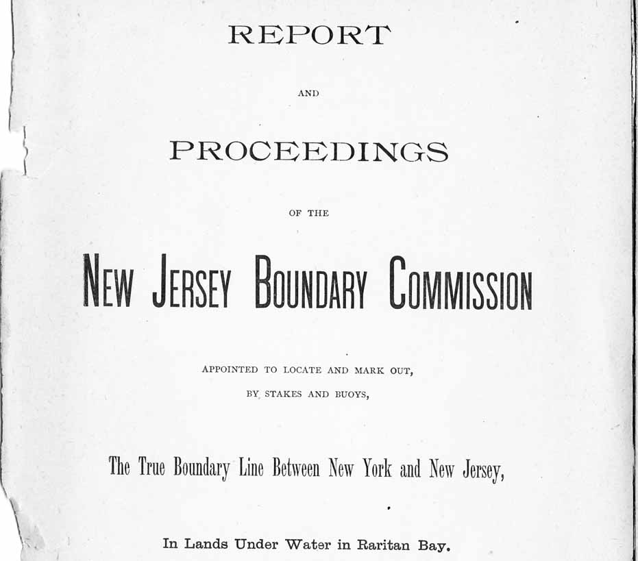
The resulting 46-page Commission report was entitled, “Report and Proceedings of the New Jersey Boundary Commission Appointed to Locate and Mark Out, by Stakes and Buoys, The True Boundary Line Between New York and New Jersey, In Lands Under Water in Raritan Bay”. It includes a color map of the bay – a significant portion of which is included on this posting – and is divided into the following major sections:
- Title Page with a letter of report submittal from the Commission to the Governor of New Jersey
- Report to the Legislature of the State of New Jersey
- Proceedings of the Joint Commission Agreement
- Appendix – Correspondence
- Original Agreement [1834] As To Boundary Line
- Financial Statement
The definition of the boundary is covered extensively on this to-be-reposted page.
Below is a summary of what occurred in the resulting twelve commission meetings which took place between April 29th and November 30th, 1887.
Attendance:
Here is the list of the commissioners and their attendance record. Two of the six commissioners attended all 12 meetings. Two missed one meeting. One, the Chair, missed four which caused the commission to have to appoint Prof. Cook as Chair pro tem at one point (meeting #11). One missed seven of the 12 meetings (over half). Here is the attendance record of the six commissioners; a number indicates the meeting was attended and a ‘-‘ means they were absent:
New Jersey:
- Prof George H. Cook: 1 2 3 4 – 6 7 8 9 10 11 12
- Robert C. Bacot: 1 2 3 4 – 6 7 8 9 10 11 12
- A. B. Stoney (Chair): 1 2 – – 5 6 7 8 – 10 – 12
New York:
- Robert Moore: 1 2 3 4 5 6 7 8 9 10 11 12
- Lieut. G. C. Hanus: 1 2 3 4 5 6 7 8 9 10 11 12
- Mayo W. Hazeltine: – 2 3 4 – 6 – – – 10 – –
Committees:
Five committees were identified during the active period of the Joint Boundary Committee. Here is the list of the committees, which meeting the committee was formed in, and which commissioners were appointed to them:
- Committee to “examine the records and collect and prepare information necessary for the use of the Commission.” Meeting #1. Bacot and Hanus.
- Committee to “communicate with the Light-House Board and request that the Board furnish the Commission with the necessary buoys.” Meeting #1. Cook and Hanus.
- Committee to “compute the areas of the waters of both States included in the treaty of 1834, and also to determine the headlands to be taken as forming points on each shore from which calculation should be made of areas of coves.” Meeting #4. Bacot and Hanus.
- Committee to “visit Washington, and endeavor to ascertain what were the headlands forming the entrance to Raritan Bay.” Meeting #6. Cook and Hanus.
- Committee to “locate and designate the point where the break in the boundary line between Great Beds light and Romer beacon should lie”. Meeting #8. Bacot and Hanus.
Meetings:
Meeting 1 – Friday, April 29th, 1887 – Astor Hotel, New York, NY:
- Elected A. B. Stoney as Chairman and Edward P. Doyle as Secretary.
- Robert C. Bacot (NJ) & Lieut. G. C. Hanus, U.S.N. (NY) appointed as a Committee to Examine the Records and collect the information necessary.
- Three maps were ordered from the U.S. Coast and Geodetic Survey.
- Prof. Cook (NJ) & Lieut. G. C. Hanus, U.S.N. (NY) appointed as a Committee to Communicate with the Light-House Board to request for the Light-House Board to provide the necessary buoys to mark the to be defined boundaries.
Meeting 2 – Monday, May 9th, 1887 – 47 Montgomery Street, Jersey City, NJ
- Lieut. Hanus indicated that he and Robert C. Bacot visited Washington, D.C. but needed more time to acquire the necessary records.
- Prof. Cook indicated the Secretary of the Light-House Board was “adverse to granting the request” of providing “certain assistance”, i.e., buoys and assistance in placing the buoys.
Meeting 3 – Monday, May 16th, 1887 – Astor House, New York, NY
- No business was transacted.
Meeting 4 – Thursday, May 26th, 1887 – No location identified
- In an attempt to determine a legal precedent for defining the boundaries, Lieut. G. C. Hanus reported the Committee to Examine the Records had “visited libraries in New York City, consulted a great number of authorities and made a personal investigation among the archives of the State Departments at Washington, Albany and Trenton” as well as viewing “Several hundred books, pamphlets and maps, bearing on boundary settlements.”
- Lieut. Hanus concluded that there was no already existing precedent to “define what is meant by the middle of an arm of the sea where (as in this case) the shores are not parallel, and where the value of land under water has to be taken into consideration.”
- The Boundary Commission Report itemized extracts pertaining to boundaries from a number of sources, including state constitutions, state or federal laws, etc.
- Lieut. G. C. Hanus U.S.N. (NY) & Robert C. Bacot (NJ) were appointed as a committee to “compute the areas of the waters of both States included in the treaty of 1834, and also to determine the headlands to be taken as forming points on each shore from which calculation should be made of areas of coves.”
Meeting 5 – Monday, July 11th, 1887 – No location identified
- Three of the six commissioners, two from NJ and one from NY, did not show so the meeting was cancelled.
Meeting 6 – Wednesday, August 17th, 1887 – No location identified
- The committee which was asked to compute the areas per the 1834 treaty was not able to come to an agreement. “No action was taken on the report.”
- Lieut. G. C. Hanus U.S.N. (NY) & Prof. George H. Cook (NJ) were “appointed a committee and authorized to visit Washington, and endeavor to ascertain what were the headlands forming the entrance to Raritan Bay.”
- Probably in response to the absence of three of the six commissioners at the July 11th meeting, it was agreed that votes for each state could be allowed if two commissioners from each state were present.
Thus a quorum was defined to be possible with a minimum of four commissioners providing two were present from each state.
Meeting 7 – Saturday, August 27th, 1887 – No location identified
- The committee assigned to determine the headlands forming the entrance to Raritan Bay visited the Office of the Secretary of State in Washington but “could get no information that would tend to settle the questions in dispute.”
Meeting 8 – Tuesday, September 6th, 1887 – 9am – Tug Boat M. F. Cahill in Perth Amboy, NJ
- Five of the six commissioners took a tug boat ride around Raritan Bay.
- After the trip completed, the meeting was held in the cabin of the tug boat.
- Lieut. G. C. Hanus U.S.N. (NY) & Robert C. Bacot (NJ) were “appointed a committee to locate and designate the point where the break in the boundary line between Great Beds light and Romer beaconshould lie.”
- The commissioners agreed that the boundary “line from Great Beds to Romer beacon should have but one turning point.”
Meeting 9 – Wednesday, September 21st, 1887 – 47 Montgomery Street, Jersey City, NJ
- Due to the absence of Chairman A. B. Stoney, “Prof. George H. Cook was made Chairman pro tem.”
- This was the most important meeting held by the Joint Boundary Commission as it was the one were the commissioners agreed on the definition of “The True Boundary Line Between New York and New Jersey In Lands Under Water in Raritan Bay”. The detailed description of this line is described in the March 21, 2010 posting on this Morgan-NJ.org web site.
- Secretary Edward P. Doyle was directed to arrange for a meeting with New Jersey Governor Robert S. Green and New York Governor David B. Hill.
- The committee on Buoys was requested to “visit Commodore Benham and ascertain what could be arranged with the Light-House Department, as to procuring buoys and setting them.”
Meeting 10 – Wednesday, October 12th, 1887 – 39 Nassau Street, New York, NY
- Secretary Doyle reported that he had visited with New York Governor Hill who “while unable at present to help the Commission, was favorably impressed with its work and would render what he could in the future.”
- Lieut. Hanus reported “that the Light-House Board agreed… to sell the buoys needed to the Commission at cost, and to loan a “tender” to place them.”
- Lieut. Hanus reported “a plan for a permanent monument, to be erected at the turning point in the boundary line”.
- Lieut. Hanus reported New Jersey Governor Green “agreed to approve the bills for the expense necessary for the purchase of buoys and the erection of monument.”
- Robert C. Bacot (NJ) and Lieut. Hanus (NY) were given “full authority” to “place the eight buoys on the line agreed upon, at such points as shall, in their judgment, seem proper” and “to build a permanent monument at the point agreed upon.”
- The Committee on Buoys was instructed that the permanent monument’s cost was “not to exceed four thousand dollars ($4,000), one-half of which sum should be paid by New Jersey and the other half by New York.”
- Correspondingly, the cost of purchasing the eight buoys were “not to exceed four thousand dollars ($4,000) in all, one-half of which sum should be paid by New York and one-half by New Jersey.”
- The entire Joint Boundary Committee formally signed the boundary agreement.
- After signing the agreement, the Commission determined the compensation for Secretary Doyle ($500) “half of which sum should be paid by New Jersey and half by New York.”
Meeting 11 – Monday, October 31st, 1887 – 47 Montgomery Street, Jersey City, NJ
- Lieut. Hanus informed the Commission that the Navy was requesting for him to return to his ship on November 7, the date previously communicated to the Navy by Lieut. Hanus, and requested the Commission to identify a substitute for him on the Committee on Buoys, etc. The commission identified Robert Moore to be the substitute should Lieut. Hanus need to return by that date.
- The Commission adjusted the maximum amount to be paid for the permanent monument from $4,000 to $6,000 and directed for the committee to use iron for its casing.
Meeting 12 – Wednesday, November 30th, 1887 – 47 Montgomery Street, Jersey City, NJ
- Prof. Cook reported that Secretary of the Navy Whitney granted the extension of the leave to Lieut. Hanus until December 4th, 1887.
- 2,000 lithograph copies of the map showing the boundaries on Raritan Bay were ordered – 1,000 for each state.
- Lieut. Hanus reported that he and Mr. W. G. Ford, Jr. had marked out the position of the permanent monument using five stakes and a “second-class wooden spar-buoy”.
- Lieut. Hanus also reported that with the aid of Ensign G. R. French, U.S.N., one of his assistants from the 1886 Survey of Raritan Bay, and a light-house tender loaned from the Light-House Board, all the buoys were “placed” on the boundary line.
This posting and the related postings show most of the “Map of the Boundary Line between the States of New York and New Jersey in Lands under Water in Raritan Bay” from the Boundary Commission Report dated October 12, 1887. Click here to view the entire map of the Joint Boundary Commission’s report from the Rutgers University Special Collections.
Note that at this time I don’t have information indicating when, where or by whom the Permanent Monument was manufactured or when it was put into its permanent location where it remains to this day.
The boundary agreement document, dated October 12, 1887, was “placed on file in the offices of the secretaries of state of the respective states”. Ultimately, for Raritan Bay the findings of this Joint Boundary Commission superseded the previous agreement and remains the definition to this day.
Originally posted on April 4, 2010.