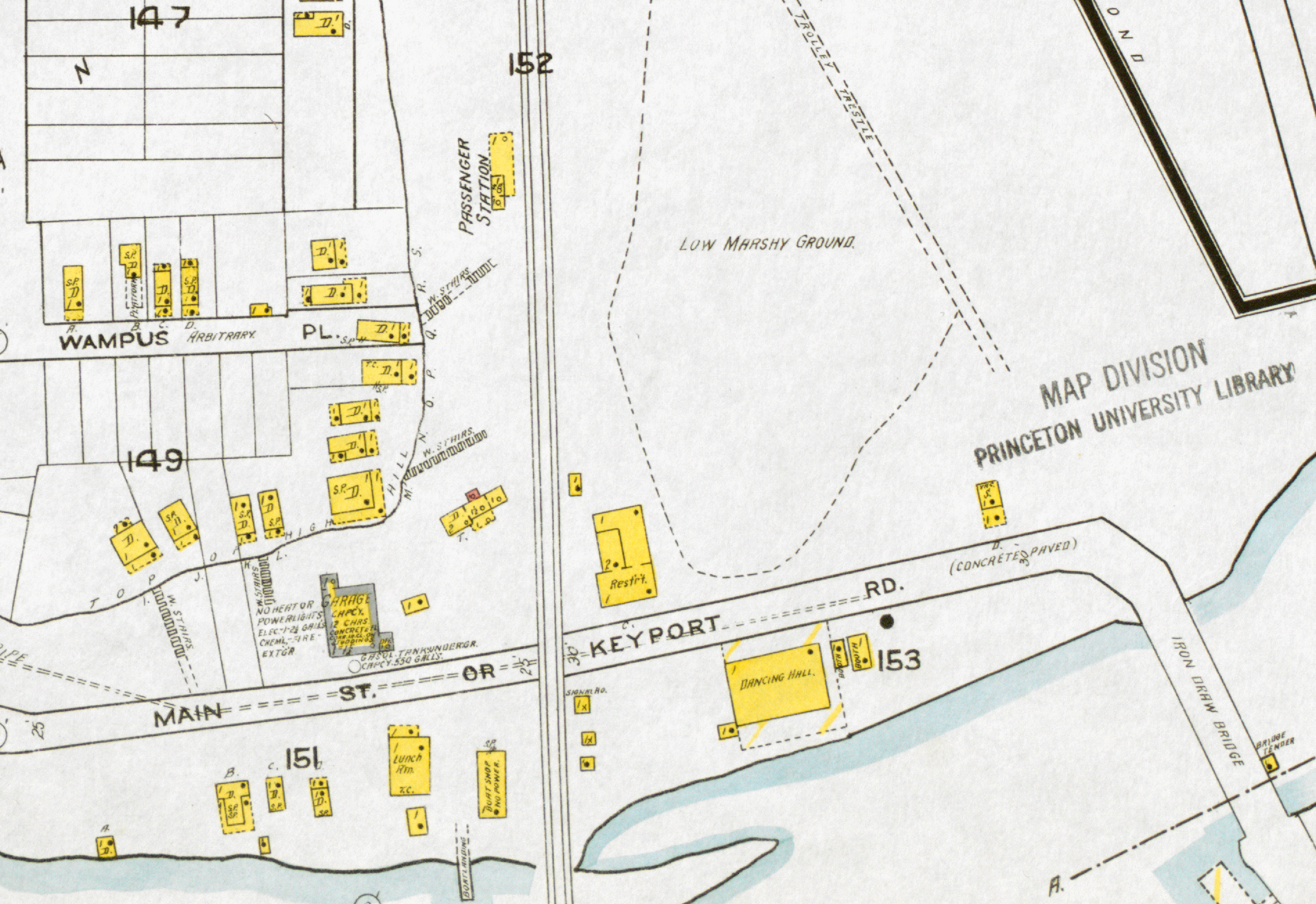
1919 Sanborn Fire Map of the area around Morgan Station.
The vertical lines in the center of the image are the tracks of the New York & Long Branch Railroad. The building marked “Passenger Station” is the shelter building known as “Morgan Station”. “Low Marshy Ground” is the original mouth of Cheesequake Creek. “Iron Draw Bridge” is the 1913 road bridge over Cheesequake Creek. The structures on the right side of the area marked “149” are the bungalows in the picture-post-card shown below. “W. STAIRS” are the wooden stairs seen in the picture-postcard, below.
Today, the portions on the right side which indicate “TROLLEY TRESTLE” and “IRON DRAW BRIDGE” are essentially New Jersey State Highway 35 where it crosses Cheesequake Creek.
Image courtesy of Princeton University Library. https://maps.princeton.edu/catalog/princeton-qj72p925g