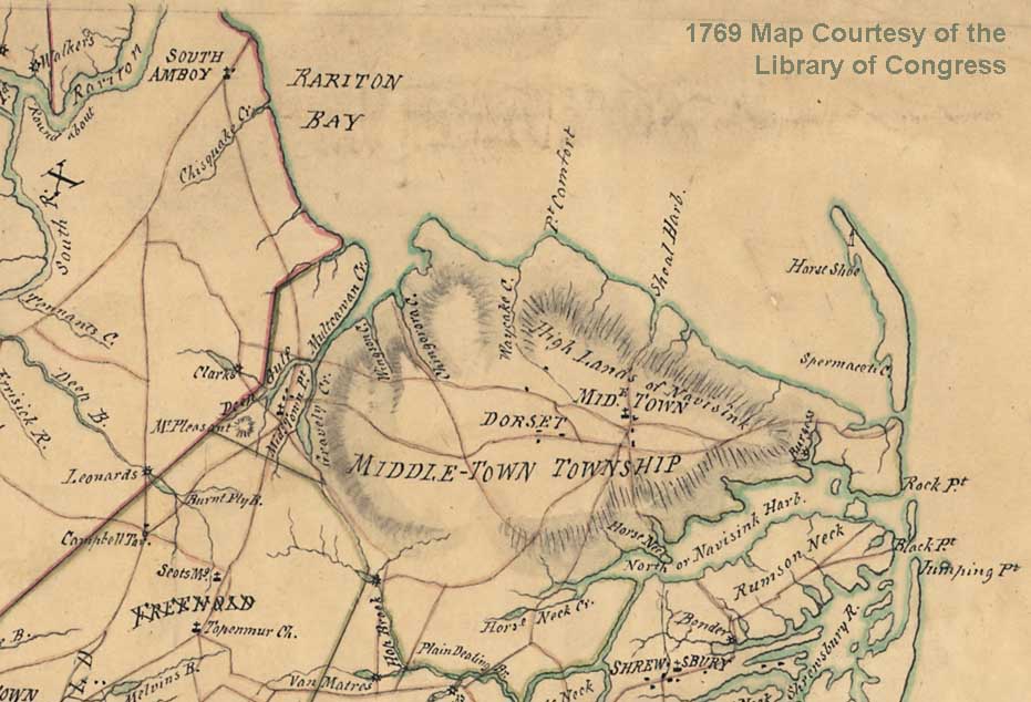
1769 – LOC Map of Raritan Bay Shore

1769 Map of the Rariton (Raritan) Bay Bayshore. Chisquake Cr (Cheesequake Creek) is shown below South Amboy. Image courtesy of the Library of Congress. Digital Id: http://hdl.loc.gov/loc.gmd/g3811f.ar124500

1769 Map of the Rariton (Raritan) Bay Bayshore. Chisquake Cr (Cheesequake Creek) is shown below South Amboy. Image courtesy of the Library of Congress. Digital Id: http://hdl.loc.gov/loc.gmd/g3811f.ar124500

Leave a Reply

Your email address will not be published. Required fields are marked *