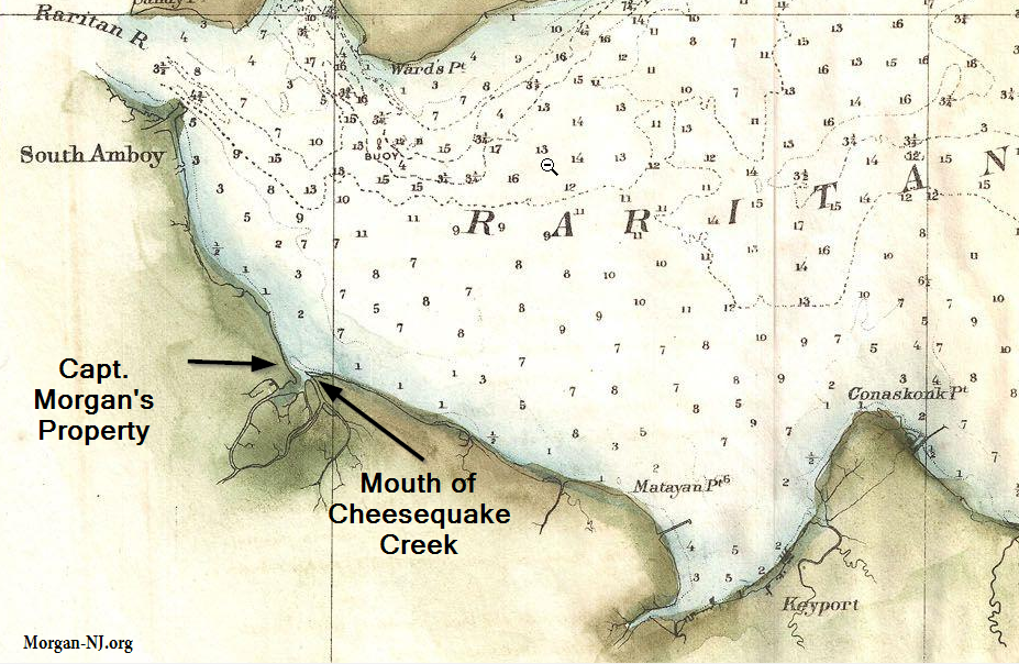
1857 chart of western Raritan Bay showing the location of the mouth of Cheesequake Creek and its proximity to part of Capt. James Morgan’s property holdings. The British Brig Britannia was grounded and captured “near the mouth of Cheesequake Creek” seemingly in late December 1779. The numbers shown on the bay are “The soundings are expressed in feet, and show the depth at mean low water the plane of reference.” In other words, how deep is the bay at that location.