Morgan Manuscripts – 1710 Deed from Richard Townley to Charles Morgan
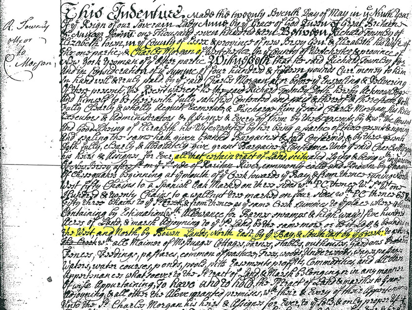
Morgan-NJ.org is excited to be able present this portion of the May 7, 1710 deed which transferred a big part of what is now Morgan, NJ to Charles Morgan. For those that have trouble deciphering the handwriting, transcribed below are some of the important sections including information indicating what some of the phrases mean as well as what we now consider to be misspellings:
This Indenture made this twenty seventh day of May in ye Ninth Year of the Reign of our Soverein Lady Anne by ye grace of God Queen of Great Britain… between Richard Townley a resident of Elizabeth town in the County of Essex & province of New Jersey… & Elizabeth his Wife… and Charles Morgan of Westchester in the County of Westchester and province of New York, Yeoman…
… and in consideration of… of four hundred & fifteen pounds pure money…
… all that certain tract of Land, scituated Lying & being within the province of New Jersey aforesaid on Southerly side of Raritan River, commonly called and known by the name of Cheesequakes, beginning at the mouth of the creek towards the Bay & from thence running North West Fifty Chains (3300 ft) to a Spanish Oak Marked on three sides with PC [Property Corner] thence West South West one hundred and Twenty Chains (7920 ft) to a walnut tree marked on four sides with PC, thence South South East Fifty Three Chains (3498 ft) to W P Creek, & from thence as up same Creek runnes to the place where it began.
Containing by estimation with allowance for Barnes swamps & Highways, Five Hundred acres of Land & marsh, adjoining to W.P Land, be the same more or Bit less & bounded on the West and North by Bowen Lands, North East by the Bay, & South East by the Creek;
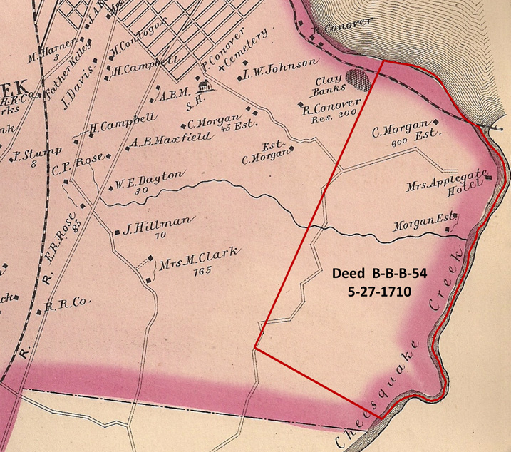
A huge thanks goes to my school friend, Joe Grabas, one of only a handful of New Jersey Certified Title Professionals, for going to the New Jersey State Archives and retrieving a copy of this deed (B-B-B-54) which transferred a big part of what is now Morgan, NJ to Charles Morgan. If you look at the “Simple List of Morgan Family Members Across the Generations” page, you will see that the Charles Morgan who purchased the property would have been Charles III, father of James Morgan, Sr.
It is also interesting to note that this deed was entirely hand written, unlike later deeds which appear to have been either typed or used a movable type printing press. This also makes it harder to read!
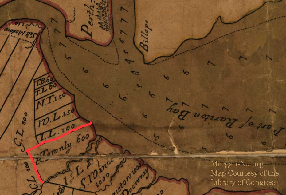
In order to get a perspective of the boundaries defined by this deed, Joe also highlighted them on the below 1876 map. Note the roads of Morgan which were already present as of 1876. Today they would be known as Old Spye Road, Route 35, South Pine Avenue, Lorraine Ave, and part of Ernston Road.
Originally posted on September 17, 2011. Library of Congress image added August 8, 2020.
The next task: Determine exactly who was Richard Townley.