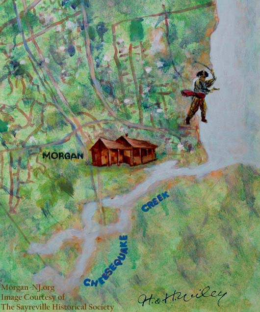
Painting of the Morgan Section of Sayreville by H & H Wiley Courtesy of the Sayreville Historical Society.
Read the new stuff by clicking on RECENT ADDITIONS, here or above.
Morgan, New Jersey is not really a city or a town but rather a political subsection of the Borough of Sayreville and named for the family which purchased the property just a little over 300 years ago. It is located on the western shores of Raritan Bay, bordered to the north by the City of South Amboy and by Cheesequake Creek to the south. The western border seems to be not quite well defined though it is, I’m told, generally understood to be somewhere around the present day Garden State Parkway.
The original “Five Hundred acres of Land & marsh” was purchased by Charles Morgan III on May 7, 1710 and appears to have remained in the family for some 200 years. Now a long established bedroom community, it was once a sparsely populated wooded area and even before that time, was presumably the home to the Lenni Lenape tribe. Since then, Morgan gained a railroad, which is still very much in use, and a state highway also very much in use. For a few decades, there was a trolley line. For some fifty years, there was a thriving beach community which was the first stop in New Jersey’s fabled “Jersey Shore.” There were markers showing the border between New York and New Jersey. For a few hundred years there was a historic inn with the legend of the hanging of a spy. Within an eleven month time period, there was the expedited building of one of the largest munitions plants of its time, or ever, and its deadly sudden and total destruction. The bluff overlooking the bay was used during the Revolution as a way to monitor enemy ship movements. One member of the Morgan family was killed during the revolution and is buried next to his father and brother all of whom were part of the Middlesex County Militia – the brother also later being a member of the US Congress House of Representatives. There is one school, two cemeteries, no places of worship I can think of, a brick road, a few marinas – even after Hurricane Sandy, a channel with two jetties, two road bridges and one railroad bridge over Cheesequake Creek, a gas pipeline leading under the bay, a number of small businesses but mostly houses and the remains of “The Woods.” If Facebook and the initial response to this web site are guides, Morgan is also very fondly thought of by the many people who either grew up there or spent a good portion of their lives there.
To view a topic, click on any of the topics to the right of the HOME button at the top of this page.
If you are revisiting, check out the new stuff by clicking on RECENT ADDITIONS here or to the right of the HOME button at the top of this page.
Thank you for your hard work on this web site. I enjoy the articles and information you provide. I grew up in Morgan not knowing much of the history unfortunately the schools tought us nothing about our own great town.
Thank you
Darrell
hi Darrel, made it back to Morgan….. long time no see….
Hello Verne! I, Jim Maciejewski, had posted a modern day map used by the Sayreville Auxilary PD on Morgan’s fb group page about 2 years or so ago. It shows the GSP, Garden State Parkway, as being the borderline and not Rt 35. There’s a few streets that run off the main road, Gondek Dr, that is used to get to the docks/boatyards off the Cheesequake Creek off Ernston Rd today. Plus there’s a small development off Rt 35 on St Peter Dr, near a jughandle off Rt 35 near the South Amboy boderline, that runs out to the GSP. Good to see the site up and running again. It’s a great learning tool and very interesting. Thanks for all you do, Jim Maciejewski.
Welcome home Morgan.com …..welcome home !
Thanks, Al! Good to be back! See you in August?
This is absolutely amazing site!
I moved here not long ago and I fell in love with its historical significance. I now live at what was called 40 horses. I would love to have a cocktail hour at my place for folks who love this area.
You definitely should! Growing up, my neighbors in Morgan were great!
Love this site. I grew up at the Robert E. Lee (1960 – 1973). Would love to see someone develope the property that the Robert E. Lee was.
So would we…. let’s invest!
Loved the lee when ever we wanted something to do it was let’s go to Lee! would love to see something nice go in there as well.
My boys used to fish the jetties and dock boats for the diner’s at the Lee great memories
Great website. Very informative about the neighborhood that I spent a good portion of my youth. Had no idea there was such historical significance there.
One incident I remember somewhat clearly is an event that occurred in the summer of 1997. While the movie “Star Wars” was released that summer, some sort of freight train was broken into on the NJT railroad tracks in Morgan just steps from the now defunct dirt cliff “Suey.” The freight car contained an overabundance of “Star Wars” action figures that were promptly taken and the entire area surrounding the tracks was littered with opened and discarded Star Wars’ action figure packages. I was only 6, but remember this quite vividly…mostly because I got there too late.
Anyone else remember that event?
Correction. The summer of the great Star Wars action figure caper was the summer of 1977, not 1997…sorry for the type-o.
Also, what is now Parker Court, which showcases luxury homes that were constructed in the late 1980s, is where “Suey” once was…and not too far from the cliff was what appeared to be a semi-constructed rail bridge. Anyone familiar with that and story behind it?
Hi Dave,
The semi-constructed rail bridge you mentioned would have been the Morgan Range Beacon, a.k.a., “The Rocket Launcher”. See the link under “Morgan’s People & Places”:
http://www.morgan-nj.org/blog/sample-page/morgans-people-places/the-morgan-range-beacon-a-k-a-the-rocket-launcher-2/
Verne
Hello Verne:
On June 21, 2014, I posted the message below under “Morgan Family Members Visiting Morgan Family Cemetery.” The message is awaiting “moderation”. I want to make sure that my message gets posted, since I would like to communicate and share info with other descendants of Charles Morgan of Gravesend. Perhaps you could send me an email to let me know when my message has been posted. My email is included in my original message, minus the “@” sign.
Thanks.
Rick Morgan
================================================================================
Dear Morgan-NJ.org:
I just came across your post about a gathering of Morgan descendants in Morgan, NJ in 2011. I’m responding to your invitation to hear from other descendants of Charles Morgan of Gravesend, New Amsterdam. Some 30 years ago I traced my family’s Morgan surname back to that Charles Morgan, whom I suspect was the first Morgan to reside in what is now New York State.
I would love to connect with others who share my Morgan ancestry. I’m happy to share my Robert Moore Morgan family tree, which may be accessed at http://trees.ancestry.com/tree/66385744/ if you have a membership in Ancestry.com (otherwise, send me an email). My 1985 report The Ancestry of Rev. Walter A. Morgan includes chapters on Charles Morgan I of Gravesend, Charles Morgan II of Flushing & Perth Amboy, along with subsequent generations of Morgans in CT, NY, OH and IA – just google the title.
It’s wonderful that there are still descendants of Charles Morgan I in New Jersey! Let’s keep in touch.
Rick Morgan
5902 32nd St, NW
Washington, DC
MorganRick50
Gmail.com
21 June 2014
Hey Verne, my name is Jim Foley and I’m the Historian for Deal Borough and also involved with the Long Branch Historical Museum, I came across the information that Captain James Morgan”took a ship” near Long Branch in August 1777. The ship turned out to be the Brig William and Anne and a Court of Admiralty was convened and the Brig sold. Do you have any more details about this? Would love to know.
Thanks Jim Foley
Thanks, Jim! http://www.morgan-nj.org/blog/sample-page/revolutionary-war-times/morgan-moments-capturing-brigs/
Hello, you probably aren’t still monitoring but if you are… what did you mean by “the now defunct dirt cliff “suey”… i only ask because we are looking to purchase a home there and googling led me to your post. Any opinions or information would be so valuable to us.
Hi Kelsey, Morgan is a great place to live IMHO. Big and Little Suey were hills, were both developed, and don’t really exist anymore as we remember them.
Kelsy, Suey was a popular drinking spot back in the mid 80’s and probably prior to that. There was one unique tree which held a keg perfectly. And as i recall it was at the edge of the cliff which overlooked the woods, tracks and the bay. Alas is is all gone. Developed into what is parker court and Morris court. Good times and fond memories. If you are purchasing a home in Morgan you will be happy. It is a nice neighborhood.
Hey kelsey,i lived on vineyard ave,that was our childhood hangout,Big Suey,near the morgan cementary,we had a Tarzan over the hill,thete we would swing out on a rope over the hill,it was a big partying spot,it was near a bridge we called the rocket launcher,it was a great town,I’ve left the state in 2023 for georgia,you will be happy in that development
I moved out of Morgan in 1976,so wasnt there for the Star Wars freight.But was there a few years earlier for the Miller beer and the Big Wheels trains being broken into.We carried cases of warm Miller beer to our underground fort at the bottom of the hill behind the Babe Ruth ballfield.Lots of drunken nites.
HELLO…….MORGAN
Was trying to connect with a group called you know you`re from Morgan if…was uunable to do so but I came upon this site instead. I grew up in Morgan and really enjoyed reaading the historical background. I remember being told as a child the that one member of the Morgan family was Morgan the Pirate and he docked his ship on Morgan Beach. Obviously not true! I was a very gullible child! Thank you for providing me with more accuratte information.
Darren, I thinks its because we hit the hippie stick one to many times. A fellow Morganite..
The metal bridge was known by us as the three stones…. The hills were big suey, little suey, transco, maniac, big tit and a few others what good memories.
Great memories and good times at all those spots Enjoyed growing up in morgan
Linda this is Sheila from college pls call me 2013424668 smassoni1@verizon.net
Verne. we have similar first names and a love and sense of awe for our childhood home. I am so happy that I found your blog. Both my husband Bill and I grew up in Morgan and enjoy your extensive research on the history of our small charming town.
Thank, Vernie! It is a great place to be from and has a lot of history for such a small spot!
Pretty extensive information on Morgan and it shows a lot of love and work that you put into this website.
Is there really as site “you know you grew up in Morgan NJ if”… Where is it?
Hi Chuck,
It is on Facebook. You can find it on a Facebook search. It is nicely moderated by Dave Riley. https://www.facebook.com/groups/111427382292288/
See you there!
Verne
Chuck Muth…looked for you around morgan, you must have moved…still have pictures from when we were growing up in morgan and with our families getting together in Miami and Stuart Fl. on vacation trips. I don’t do Facebook or that other stuff, but I do e-mail…my address is— cousincop@yahoo.com
I see your sister is on here also…I still go back to Morgan several times during the year…hanging out at the Lockwood’s marina or the local watering holes…
This website sure brings back alot of Memories…
Verne,
In bed and bored. Reviewing south amboy citizen to pass the time.
Check out Jan 25th and Feb 1. This was right after Gillespie exploded. They apparently gave one of their remaining buildings to the YMCA and “Camp Morgan” was opened. A “canteen” providing for, entertainment, etc. for the soldiers.
Ever heard of this? Any idea where the building was?
Hope you are well.
Sue Meyer
In 1919 or 1920 after the Gillespie explosion there was a public sale of the remaining building at the sight. My uncle, Fred Dietrich went to the sale and purchased a buildilng with 2 rooms. He built a trailer, loaded the building on it, and moved it to Church Street in Matawan Twp ( which is now Aberdeen Twp) and attached it to the rear of existing house. This house with the attached building from Gillespie is still in use. This property was originally purchasd by my Grandparents in 1892 and I still use it.
Very cool!! What was the building made out of? I’m guessing if your uncle was able to transport it in 1919/1920 that it would not have been a brick building.
Does anyone remember the gas leak explosion that leveled many of the homes behind the Club Bene? Was that land ever redeveloped? I moved from Morgan to Maryland in 1988 and have been back but never went back there to see.
what was known as the Morgan Circle is now a lovely area with custom 2500 Sq Ft + luxury homes
I remember the explosion. I lived across the swamp on Hillcrest Ave, in Laurence Harbor. The concussion I felt was like someone dropped a pallet of bricks on top of my roof. Really the shock wave was in line of sight to me across the swamp.
Thanks for the info. Wonder how or where we would be able to get more specifics on this. Any ideas?
It was the house I grew up in… I think.
Carol Vittoria (Frank) I lived around the corner on Second St. when that explosion took place. Someone hooked up a propane tank in their house on Morgan Ave. or in the Circle. It was a huge mess! Luckily, the neighbors were all working and kids were not home from school. No One was hurt. Homes on Morgan Ave. Were a mess with broken windows and trash was blown clear onto Old Spye Rd. and into our yard and Tree. Very Scary. Thank goodness, the school bus driver saw flames and smoke as she was driving into neighborhood and stopped short, keeping kids on bus until it was safe for them to go home.
I consumed too much beer gazing at a wonderful view of South Amboy Waterworks at a long gone place we all called “40 HORSES”.Smoked all the bones I could smoke next to the baseball fields and JESSE SELOVER SCHOOL.(they throw ya in jail for doin’ that sorta thing these days).Many of those folks from then are dead and gone,but I have my memories…
Hi I’m looking for Verne Muth. We are cousins and haven’t seen Morgan or talked to her in a long time. Hadens and Browns are mutual relatives
My great-grandparents Herman and Christina Springer used to live on the very south end of Morgan Avenue back in the late ’60s and early ’70s. I remember coming down the brick road to see them. I see all the houses on the cul-de-sac have been replaced. I remember sitting on his back porch and looking at the railroad bridge. Great web site– thanks for all the work.
Thank you. I believe I recall your great grandparents if they were the ones still involved with Cub Scouts. They were also known for the length of their marriage.
Great site. I lived in Morgan for 62 years and just moved recently. It’s changed alot but I still love it!
What a fascinating and informative site. I recall many joyful hours as a child in Morgan. If Bill Love is reading this, I am Jamie Bauer. You and I and Michael Teliszewski were playmates. I recall playing forts and other castle games in the Bloodgood’s magic castle. My mom chatted with your mom while we played and she, at 93 and still well, also recalls those days.
My family built two houses in Morgan upon my Dad’s return from WW2. Of course I wasn’t born yet, but my older brother Bruce was born in 1947 when they lived in the first home at 49 Vineyard Ave. I was born when they lived in the second home at 193 Morgan Ave overlooking the cliff and bay. That house was an over-under duplex mother/daughter where we lived with my grandparents. My grandfather built a bench out behind the outdoor fireplace/grill, on the edge of the cliff, where we would sit and wave at the trains as they passed by. Often the engineers would blow the whistle for us as they passed. What a treat it was when we’d see the occasional steam locomotive still in use as they were phased out and replaced with diesels.
My grandfather often took me along on his walks all over town. I recall sitting at the bar in Picky’s while my grandpa ate complimentary hot cherry peppers from the big glass jar, drank draft Piels and kibitzed with his pals. We’d go for a burger at Molly’s. I walked with him down Old Spy Rd, past the inn, which was still a functioning shop of some sort, and on down to The Robt. E. Lee where he’d shoot pool in the bar. We went to the beach across from the Robt. e. Lee. where I recall helping hundreds of hapless, inverted horseshoe crabs to right themselves and then crawl off.
My mom worked the counter at Gene’s for a bit, where we’d often go for a dog and root beer or ice cream. Between 1951-53 my parents owned the confectionary, ice cream shop and soda fountain on Stevens in South Amboy a block or so from St. Mary’s.
My kindergarten class at Jesse Selover had a set of identical twin boys, which were quite interesting at the time. I think they lived near the south end of either Liberty or Luke St. I recall my brother and I having many baseball cards which came packaged inside the Bazooka gum Mr. Ryan gave us when we filled up on Sunoco at his station. On a few occasions my brother Bruce dated Mr. Ryan’s daughter, once she went with my brother and our family to Palisades Park.
There is a paragraph in an Exupery book about the dark and golden park that we, as adults, can never again enter. The vacant lot and field on the corner in front of our house and the Johnson’s house on Morgan Ave was that place for me. Years later, when I went back to visit my grandparents who remained after we moved, the lot had been sold and a brick ranch with trimmed lawn had been built. That was a sad day for me.
One summer in the late 80s I was vacationing with my family in Boothbay Harbor, ME. We went on a vintage steam train ride and visited the local railroad museum. Imagine my surprise to see a photo in their collection taken from the Rt. 35 bridge looking up the tracks at a steam locomotive making head south behind our house. This is only tiny smattering of my happy recollections, but as others have written… Thank you much for this great work.
Hi Jamie!
Glad you enjoyed the web site. It is a great place to be from and you mentioned many of the reasons for that. I forwarded your email address to Bill Love. Per chance, do you have any photos or artifacts from your childhood which I might be able to use in future pages on this web site? A photo of Gene’s, Molly’s, Millie’s, Ed Ryan’s Sunoco, Ernie Frank’s Texaco, or the inside of Kozy Lanes would be awesome! I remember your home and used to deliver newspapers there. Didn’t it used to be the third house from Route 35? I’m thinking something was knocked down at some point. The Johnson’s were my neighbors and were so great. Mrs. J lived to be over 100! I would love to see that photo in the Maine museum.
Verne
Verne, The Johnson’s were your neighbors? Which house did you live in? The Johnson’s were our next door neighbors. Robbie Johnson was my brother’s friend. Thelma used to babysit us occasionally.
Yes, it was the third house from route 35. There was Gene’s on Rt. 35, then the Dreilings (sp?), then the Farkis’, then our house, then the Johnson’s with the vacant lot on the corner.
My Mom has scrapbooks and scrapbooks filled with memorabilia, but I cannot vouch for any of the exact content. I will ask her and see what we can find for you. I will get back to you.
Jamie
This is unbelievably wonderfull to hear. I was not their neighbor. My parents had helped my aunt molly, my fathers sister, purchase the home and we were invited as guests for a few seasons. I was only 10 or 11 and my sister marie was closer to Thelmas age, who if Thelma is around would be about 78-79. Thelma would recall all even though I don’t recall any family ties after those years. They were such fond memories and such a beautiful place I would like to walk the short distance to where the Robert E Lee wasonce more.
hello verne–I think I have just written the wrong person a Jamie and was exicited to see your reply until I just realized it was written 2/24 to Jamie. I will make it short as I have been typing in length for an hour. I am up in my 70s now but spent the summers of 1949-50-51 at my fathers sisters home which I have many fond memories and I think was next door to you. I would love to know if my cousin Thelma is still in morgan. My name is maresca and her moms maiden name was maresca also and became molly Johnson. I have tried many times to find the location but could not even find morgan. After visiting this site I am confident I could now find the house and would love to walk the short distance we did as kids to swim near the Robert e lee. In those years it was easy access but I might need an escort now cause it has been 60+yrs and might not be open access property along the cliff. If you could help I would be very grateful.
Hi Mr. Maresca,
Ironically I don’t live anywhere near Morgan anymore. I have lived in California for quite a long time now! I did post your question on a Facebook site specifically about Morgan and will let you know what answers people come up with. Many years ago all of the houses which used to be on the “Morgan Circle” were demolished and three or so houses built in their place. I couldn’t tell whether your cousin lived on the circle or on Cliff Avenue. If you try to look for Morgan, you’ll likely not find it. Morgan is actually part of the Borough of Sayreville but uses a South Amboy zip code. Endlessly confused me as a kid but makes sense to me now. Also confusing is Sayreville War Memorial High School being in Parlin!
Please note that at this time I only check this web site a few times a month so replies may on occasion take a little time.
Thanks,
Verne
Just a short note to thank you for your warm and considerate response to my request to learn about my aunt Mary Johnson(my fathers younger sister} whom you mention, lived to be 100, and my cousins Thelma, and Robert ,whether they still survive. You and another individual a { Jamie Bauer) claim to have been their neighbors and my cousin Thelma would babysit them in their youth. Yet you simply disregard any decent form of a reply to an elder mans request for any kind of assistance. We were different people in that world back then . I am not a criminal or a predator nor did I wish to join your group, just looking for some acknowledgement from the kind of people that lived there when I spent three summers in my aunts house.Your site seems to be made up of a generation of much younger morganites who loved the area they grew up in . I wish you luck and continued good health. May I suggest, if you do not want any more horrible requests like this ,you take this site off the web.—– regards — Anthony and Angela Maresca Long Island NY
I have been looking for several years for the location of the home of my fathers sister molly[ maresca] Johnson . They had a home on the cliffs overlooking the bay and below the cliff there was railroad tracks . I vacationed several years there in my youth with my sister and parents .The johnsons had a daughter named Thelma, and I recall we could walk out the house to our right a short distance, along the cliff, go under a bridge and swim by the Robert e lee restaurant. I have tried to find it always thinking it was off rte.9, because we had other family in Lakewood and we would pass over the bridge and see the Robert e lee on the right on our way to Lakewood. After viewing this site I realize it is rte 35. You mention family elders that may recall. There was also a very popular actress by the name of Dagmar that rented an apt upstairs for a year or two. I am talking about summers of 1949-50-51. If you could provide me info or direct me to the chamber of commerce for the area I would be very appreciative. I am up in my years and would like to see the area once more or know if my cousins are still in the area.
I think the street you are looking for is Morgan Ave.
It is the st. behind the now Fernandez steakhouse near the Morgan Bridge off of Rt 35 North bound side
I believe the house was towards the end on the right.
That was the Morgan Circle, it’s now a beautiful culdesac with huge homes.
Hi Jamie. I just (Oct. 25, 2015) stumbled across my name in your post above. Our playtime must have been at the dim recesses of my early years because I must admit I’m having a hard time remembering you. Were you a bit older than me? I was born Dec. 20, ’55. Help me out when you see this, OK?
Jamie, I was living in one of the cottages with my mom and stepdad in 1948-49..I remember my mom walking me down a brick road that was very spooky to me with trees over hanging it, there was an elderly ady that lived in a house on it..We climbed up wooden steps to the top of a hill and there was a play ground up on the road we would go to…I’m sure it’s all changed now..
GLAD TO HEAR SOMEONE STILL REMEMBERS THE 50S. MY DAD OWNED COVERTS FARM MARKET ON RT 35, BETWEEN MIDLAND AND VINEYARD AVES
HI JAIME, YOU ARE SOMEONE WHO REMEMBERS ALL THE PLACES I KNEW OF GROWING UP IN MORGAN. MY DAD OWNED COVERTS FARM MARKET ON RT 35 AND MIDLAND AVE. MAYBE YOU REMEMBER
yes i knew you lois i remember your dad’s fruit and vege. stands on the highway, he also had christmas trees i use to live in union beach and knew your family from there and morgan. hope you will ans back to me anne
SORRY I DID NOT ANSWER YOU ANNE. DAD SOLD THE STAND IN 59 AND I MARRIED KEN BRYLINSKI FROM GABRIEL TERRACE. WE BUILT A HOME IN 64 ON RARITAN AVE. WHERE DID YOU LIVE? HOPE YOU ARE WELL.THANK YOU FOR ANSWERING MY TEXT. MOST PEOPLE KNEW ME AS LOIS VIVIAN WAS MY MOMS NAME TOO SO I WAS CALLED BY MIDDLE NAME. I HOPE YOU ARE WELL. LOIS
I almost forgot. My grandparents and parents used to “go out on the town” at Joe’s Cozy Bar when it had a bowling alley. Does anyone else recall the hardware store or surplus shop on Rt 35 south that had the ex-German V1 buzzbomb mounted out front?
That was Morgan lumber co owned by the DiPalo bros. Gary engelhart Morgan n. J.
Hello Gary. Just seen your post here. I grew up in Morgan. It was a grate place to live!!! I had a lot of friends there. And so did my mom and dad and even my sister. My name is George Mekula. Sister Carol Ann. Mom Susan and dad George. Lived in Morgan at 9 Middlan Ave. I even think we knew each other??? If so please get back to me. My e/mail is dmangem01@gmail.com. maybe we could even shair some pictures. And the good old times we had.
I REMEMBER THE COZY BAR OWNED BY JOE BEVENNETO. I LIVED AT 1 MIDLAND AVE MY DAD OWNED COVERTS FARM MARKET ON 35
MY MADIAN NAME WAS VIVIAN LOIS COVERT
I grew up in Morgan and lived in the house on Haussling Place behind jims. Nice to see these pictures. What a great place to grow up!!!
Great web site.
Thanks! It really was a great place to be, wasn’t it? Who knew there was so much history there?
Michael, Do you remember me? We used to be playmates back in the mid 50s. I remember a lot about you and your family. Best, Jamie
Hello Michael. I just found this sight. Its great to see. I do hope that you get this. If so please get back to me. Thanks. I do know you and your family very well. Hope you remember me also. My mane is George Mekula. My sister is Carol Ann. My sister and your sister was close friends in high school. My dads name is George. And my moms name is Susan. My Mom and your mom played bingo a lot!! I remembered playing stick ball in back of Jim’s for summer after summer. Every day all day long!!! Lol lol lol. Do you remember me??? Maybe we can shair some old pictures or some good old times. Please get back to me at dmangem01@gmail.com I really hope you get this and you will get back to me. Thanks. Have a great day. George Mekula.
Puck , l took 95 like you said.
Don’t remember much as I was born in 1951 so I was a mini kid in the mid 50’s. Do remember running to the hill to watch the steam trains go by. The vacant lot in front of the Johnsons and watching the Ryans house being built. This site bought back some of the memories.
Hello Mike. Tell Annie l said hi. This is Fox.
Hi. I’m maureen Grover and I live in harry phairs house who was Morgans first fireman. Gary engelhart is my neighbor and he and Alan mosanik drove a car on the raritan bay in 1979
Hi,
Bob E here, Gary’s bro.
Mr. & Mrs. Phair were great neighbors. Mr. Phair would run down Tyler Street whever the siren would sound. Had an enormous Swamp Maple tree in their back yard that provided great shade on hot summer days.
Hello all. I’m researching the Dayton Mahogany Company, a business on or around Bordentown Ave. which flourished c. 1924-1929. Specifically, I’m interested in their employee history, and an accident that affected an employee in 1925; but I’m also interested in the business more generally. If anyone has any information on this company or advice at all on where to look, I would appreciate it. Thanks!
Hi Colin, You might want to contact the Sayreville Historical Society at SayrevilleHistory.org or visit them at their museum.
Thank you kindly for the lead! I will follow up on it.
My pleasure. Please let us know what you find out.
Grew up on Manor Street and my grand parents lived on Tyler Street. Morgan was a great place to grow up. Building huts in the woods; walking the rail road tracks; hiking in the Morgan plant. Ah…fond memories.
what evrr happen to.the spencer family they live on sout pine ave near teds hotel does any one know
Hey Alan, Danny Spencer is still alive, his brother Ronny had passed away years ago, if that’s the Spencer’s your talking about.
Alan Jaremba, Did you live on Liberty Street?
If yes, I am your old neighbor, Carolyn Kolchak Rheam.
Nice to see your name pop up.
Hello,
I am hoping that someone here may have info that I have been trying for years to find. I’m looking for information on y grandfather, Herbert S. Wilson. I have no information whatsoever on him other than he owned a speakeasy in Morgan during the depression. I’d love to see if there are any old archives, photos, anything that may link to my search.
Thank you in advance for any help!
Sorry, I have no information about Mr. Wilson, but perhaps a reader might.
Patti Spencer married John Babe Klosek they still live in Sayreville
I played little league baseball with Babe Klosek. We played for Connie’s Bar. I lived above the field on Dolan Ave.
Hello. Just found this sight. If anyone remembers me please let me know I grew up in Morgan on Middlan Ave. 9 middlan Ave. My mane is George Mekula. My dads name is George and my moms name is Susan sister name Carol Ann. Would love to here from you. Shair the good old times. And maybe shair some old pictures also!!!!! My e/mail is dmangem01@gmail.com thanks. Hope to here from you soon. Have a great day. George Mekula.
Hi my name is Donald Hannon I grew up on Morgan beach in the early 50’s my grandmother owned a store Ruan’s I left during a flood but came back every summer until they closed the beach down if anyone remembers her store or Kaisers pls reply to this website
I’m still trying to determine what year they closed down the beach?
Hey Verne. I am here due to some recent correspondence you’ve had with my oldest brother Herbert (Bert) Buehler. We lived in Morgan, on Madison Street at the corner with Stevens Ave. Caty-corner to the Muths (I saw a post earlier from Chuck and Vernie) and across from the Cottrells. I read through all the posts and was amazed by some of the names out of the past – Mr. Springer, who used to umpire home plate over at the Selover School fields, the Dreylings who were best buddies with my parents and whose grass I used to cut (until I drove Mr. Dreyling’s mower off the bluff – really!!!). I ran with a group of Morgan guys – Ed Mandell, Richie Arose, Mike Wynn, Larry Mizak, Scott Jenkins…and affectionately referred to ourselves as “the Morgan Mafia”. I delivered papers on Madison and Lincoln Streets, stopped every day at Marie’s Deli, and turned in my change on “collection day” to Helen Frank, Ernie’s wife, because they used the change at their Texaco Station. She taught me to organize the money in my wallet – heads all pointing in the same direction, by denomination – still do to this day. Russ and Louise (Buehler – my father’s sister) Sprague lived on the bluff at the end of Luke Street. Russ was Doug Sprague’s brother, the police family from Morgan. I will always consider Morgan HOME and have so many fond memories of “how things used to be”. Stick ball in the street (over the wires was a homer), view to the “light house” in the bay at the end of our street, biking to little league games after dinner and our Opening Day parade with those scratchy wool uniforms, Stewart’s Root Beer stand, climbing on the roof of Selover School, sledding down Madison street’s “big hill”, getting a hair cut at Lenny’s Barber Shop (next to Marie’s), the short cut to Rt 35 on Kath Street and the Morgan Panthers (who still exist, so I’m told). I could go on for days. Living now in TN, I still identify with my Morgan roots and rue the fact that no one around here even knows what Pork Roll is. Thanks for organizing and publishing the website. Morgan lives on!
Thanks, Dan. In an email to me, you also mentioned Keith Kelly as one of your childhood buddies and Mike Cunliffe as a school friend. There is no Pork Roll in California, either…
Hello Daniel,
This is Kevin Spiecker. I was reading through the Morgan History pages and the comments section and came across your post! Wow, what a blast from the past! Your comments brought back so many memories of our youth and the fun of growing up in Morgan. I have to apologize to you because you stopped at my old house on Wessco St. years ago and gave my parents your contact information which I promptly lost. Several years ago at a high school reunion I sat with a group of our fellow Jesse Selover classmates and tried to recall and remember some of our other classmates not in attendance. Your name came up and all I could recall was that you lived in Nashville? Tennessee. Would like to connect with you again to say hello and reminisce.
To whom it may concern, I am the granddaughter of the previous owners of the Robert E. Lee Inn. My mother was Frances “Snooky” Wynegar. She was the artist mentioned in your link for the painting of the Robert E Lee. She was the daughter of Richard and Gladys Newbould. They had three children, Mary Lou, Frances and Richard “RJ”. RJ is the only surviving child, and lived in Florida. I have a lot of photos I’d love to share with you. Inside the Inn, my grandfather was on the front page of the Newark News , July 21 1957. Lifting a huge stripped bass at the Inn. Send me an email and I’ll be glad to share photos. Sincerely,Diane Wynegar Griffin
AWESOME to hear from you, Diane! Thank you for the corrections/information – the site has been updated. I would love to see your photos and sent you a separate email.
Sorry I proof read my above entry. I have photos of inside the Inn AND a copy of the Newark News with my grandfather on the front page lifting a huge stripped bass.
Hello! My best friend and I used to work at a Club Krome when we were in high school and have great memories parking cars and getting to see free punk rock shows in the year 2000- to the unfortunate closing.
I’m getting married and as a groomsman gift for my friend I would really like to find some memoribilia from Club Krom during that era, but seems impossible to find. I’d love any advice in finding a picture of the marquee, a concert hand bill or ticket, t-shirt, anything. Thanks!
Very nice information on this site. Thanks for putting the time and effort into it. My father and his siblings were raised on Dock Rd starting in the 1930’s. I’ve spent a significant amount of time at the “steamboat landing” crabbing. The house is still in the family.
What do you know about a golf course. In 1900, Harper’s mentions Laurence Harbor Country Club. It was laid out by Tom Bendelow in 1898.
You can see the clubhouse between the trees at the top right part of the photo on this page and the white building in the middle front of the photo has a sign which reads “Golf”:
http://www.morgan-nj.org/blog/sample-page/morgans-people-places/places/view-of-morgan-beach-area-circa-late-1920s/
I’ll let Alycia, one of our contributors, know of your question. Her knowledge of Laurence Harbor is unsurpassed and we have communicated about that very place. Actually, we should do a piece about the club on this site since it was such an amazing thing to have been there at one time.
Hi reading all of the the comments about Morgan Beach. I don’t know how old you are but I visited Morgan Beach for many many years because my aunt and uncle owned Kaisers Tavern if you’re familiar with this building restaurant please let me know I’m looking for my cousin actually their daughter Virginia p e t r y k lost contact many many many years ago and would love to reconnect. I know her mom’s relatives lived in the and their last name was Kaiser
Betty Anne,
I went to school with you and Jeanne at st mary’s, was in the Fire Company Band with you both. I have been writing my Memoir for a few years, about 150 pages now. I am interested in the history of the area, particulary the village on the beach in Morgan Beach, what happened to all those homes, whether any photos exist of that area. I left Laurence Harbor after high school, did a tour in the Air Force in TX, been in CA since 1960. My brother Charles still lives in the home my father built in LH. I visit twice a year my daughter in Glen Ridge, NJ. Would like to communicate with you if possible. Best regards, John Thomson
Hello….I definitely remember the Thompson family….did you live up near St. Laurence’s church?…anything you want to know about tge Robert E. Lee or
Morgan Beach I have great memories…My sister and I lived on Shoreland Circle, behind The Glass House Restaurant on #35…… Did you have a sister?
I think she was a friend if my younger sister, Jeanne (MacRae)….. If you email me with any questions that I can help you with, please feel free to do so.
I have read most of the messages and it seems that few actually lived on the beach. I lived there from 1942 till we were displaced by a flood. We continued to go back in the summers until the closed the beach. My mom was molly Jouvin marrying William Jouvin. We lived with my moms sister Dolly Guscott who was married to Harold Guscott better know as Gussy. He was in a barbershop quartet with Irv and Vernes James dad. If anyone remembers those people please let me know. Their all gone now except for me and my two cousin’s who now live in Florida. I live in Myrtle Beach SC. So were a long way from Morgan Beach. A couple of years ago I took my two granddaughters to Morgan Beach and we walked out to the lollypop for old time sakes me my daughter and now my granddaughters I have so many happy memories of the Beach.
My mom Molly Jouvin also worked for Genes. My wife and I saw him just before he passed away
I also had my picture in the New York Daily News when I saved a duck from an oil spill in the early 50’s I had the picture but gave it to my son who lost it. If anyone knows what the date was let me know I would love to get a copy of that picture I was about 8 or 9 years old
Hey vern its Don Hannon I have tried to contact you but to no avail. Are you still on this website if so pls contact me via my email address Magralu3@twc.com I am in South Carolina now and would like to catch up on the morgan information
There is dispute regarding the birthplace of general Daniel Morgan. Hunterdon county NJ believes he was born at the union ironworks while his father James Morgan worked at the forge there. Durham pa is the more likely location. It is where James Morgan was ironmaster of the Durham furnace. Michael fackenthall of Durham served with Daniel Morgan during the revolution and stated that Daniel described the site in Durham . This James Morgan had legal disputes with George Taylor (signer of the Dec if indep), who had just leased the Durham ironworks. Then,promptly, all record of James is lost. (Note this James descended from the Montgomery county pa Morgan’s). I, therefore, have some suspicions re James loyalty. Strange how James disappeared around the same time as the execution of James Morgan for the death of rev James Caldwell. Is there some connection?
Hi Jennifer. This website follows a different branch of the Morgan Family. The three James Morgan’s this website follows are not the same James Morgan you are discussing. Sorry, I have no info on that James Morgan or General Daniel Morgan.
I am wondering if anyone might be able to give me some information about the John Coleridge “of Bayview Manor” who is mentioned in the following newspaper article from 1928. I read your article about Bayview Manor on this website which states that the house was destroyed in and explosion in 1918.. Was the house rebuilt? Was there another “Bayview Manor” in South Amboy in 1929? I am seeking information about Coleridges who lived in that area. ANY information would be greatly appreciated. Here is the text of the article. Please respond to my email also listed below.
• From The Central New Jersey Home News (New Bruswick, New Jersey), 16 Dec. 1929, Mon. Page 2
“The Metropolitan Life Insurance Company was given to judgments against former employees who were charged with failing to make returns on collections made fo the company. Frank Wronski of 9 Old Bridge road, South River, was named defendant in one action, and John Coleridge of Bayview Manor, South Amboy, in the other.”
Thank you SO much!
Sarita Cooper
grndarner@outlook.com
Hi Sarita! The house was a total loss and was never rebuilt by the Steuerwalds. Today the property is in the middle of a residential neighborhood. http://www.morgan-nj.org/blog/sample-page/morgans-people-places/places/what-where-was-bay-view-manor/
Sorry, I have no information about John Coleridge.
btw, I left out the name Coleridge – She was a descendant of Samuel Taylor Coleridge (the poet).
THis afternoon I have been tracing the addresses of the Steurwalds and it seems they might not have ever lived in the house. He owned a Real Estate and Insurance Business. Do you know the address of the house?
Sarita
http://www.morgan-nj.org/blog/sample-page/morgans-people-places/places/what-where-was-bay-view-manor/
I live in W.V. but a couple of years ago I visited in N.J. and one of the places that caught my interest was the site of the Morgan Inn, later named the Old Spy Inn from an episode that happened during the Revolutionary War. The Inn was destroyed by fire in 1976. But the legend goes, a local British loyalist, Abe Mussey, was captured by Continental Army troops in 1777 while signaling to British ships in the Raritan Bay, He was tried as a spy in the Inn, convicted in a one day trial and sentenced to death by hanging. His execution was carried out using a tree near the Inn’s entrance. I have a friend who use to go to the Inn and knew the story of it and they took me there to see where it once stood. It is sad there is not a marker or something to show of the episode that happened there. I was wondering if anyone else knows about The Old Spy Inn ? It is a bit of history that we seem to have lost along with so many other things.
Thank you for your comments! I’ve been searching, for years now, for definitive info regarding the true original history of the Old Spye Inn. Some people indicate it was originally built by the Morgan Family but the Applegate family were longtime owners. I’m still hoping that someday I’ll find some authentic historical archival document which makes it’s early origins and the spy story clear. I also really regret that I never took a photo of the place when I was a kid. It had always been there so there was no reason to assume it wouldn’t always be there. We know better now. Note, Abe Mussey was the neighborhood legend’s name I heard as a kid, too. I did find some old article somewhere which, if I recall correctly, actually had someone else’s name. Unfortunately, whenever most people write about the place, they’ll often copy something someone else wrote and further perpetuate unconfirmed info about the place.
When I was a child…fishing and crabbing in that area…rumor was common that the Old Spye Inn served as a stop on the Underground Railroad during the previous century…and later after the story had been embellished as people are prone to do…the resulting urban legend claimed that a Negro family had been entombed behind one of the walls…I didn’t hear about any bodies being found on the premises after the fire.
I live in W.V. but a couple of years ago I visited N.J. and a place caught my interest. A friend of mine took me to the site of the Old Spy Inn which burned down in 1976. During the Revolutionary War it was called the Morgan Inn but an episode during the war was the reason for the name change. The story of local legends goes, Abe Mussey , a local British loyalist, was captured by Continental Army troops in 1777 while signaling to British ships in Raritan Bay. He was tried as a spy, convicted in a one day trial and sentenced to death by hanging in the Inn. The execution was carried out using a tree near the Inn’s entrance. I was sad to see there was no marker left telling of the events that happened there. It’.s another piece of history gone along with so many others. I was wondering if anyone else knows of this story of the inn? My friend use to go to the Inn in the seventies before the fire and said there did use to be a marker there. There is nothing there now to tell the story of a little piece of history.
Likely, without some type of physical placard, it will ultimately be lost to history. As new people cycle through the neighborhood, what was know will be lost. This web site tries to find out factual info and present it, or indicate when info presented hasn’t been confirmed. The Old Spye Inn was a really cool place next to a really cool paving stone street. Fortunately, a big portion of the paving stone street remains as of the time of this writing. If you have not read about its history, check out the section on this web site.
About five years ago Ed Campbell was kind enough to take my father and I to the Morgan Cemetery to visit the graves of our ancestors. At one point he mentioned that some of the Morgan family’s slaves were interned in the burial ground. I’m wondering if anyone knows their names, where they are interned, or which Morgan’s owned them? Has anybody gone through the probate and wills to know who these folks might be?
Hi Alison! I don’t know if anyone has methodically searched probate and wills. You have done the most extensive write-up on your family that I’ve seen to date. I’ll look through my notes and send you what I have regarding names – I have seen a few names. Ed showed me a little headstone they thought was a slave headstone but I subsequently found out that it was actually for a little boy who died in the area when it was out in the middle of nowhere.
It is great of you to have donated James Morgan’s bible to the Monmouth County Historical Association!
Interesting! Thanks for looking into this. I do know that Major James Morgan’s inventory from his will lists “An Old Negro named Kate, no value,” “a Negro slave for life named Hannah, $75,” and . “One black man, a Slave for life named Ben, $175.” I just assumed that the three stones might correspond to the three names in the will, but I really need a bit more evidence of this. My understanding is that most enslaved Africans were buried in unmarked graves on farms. So, if these are the graves of the people the Morgan family owned, the fact that they have markers speaks the the value of their relationship. Or, they might not be slave graves. So, I’m wondering if anyone has given this puzzle more thought than I have.
Also, please let me know if you’d like photos of the Morgan Bible for your website. I’m happy to send them to you as attachments. Glad to support your website. It’s such a treasure!
Hi Alison! I don’t see that I have any more info regarding slaves of the Morgan Family than you have already identified. I don’t believe that any of the gravestones in the family’s cemetery are for any of the slaves. I checked out one of the stones but eventually found that it belonged to a child who was in the area and died sometime in the 1800’s. At that time, it was the middle of nowhere. Regarding the photos of the Morgan Bible, please do sent them our way! Thanks for the compliments. Some additional content is certainly long overdue.
I have just donated James Morgan’s (1756-1822) Bible to the Monmouth County Historical Association (MCHA) a month ago. It was passed down to me from his son Jonathan H. Morgan (and his wife Dinah Van Wickle Morgan, to their daughter Ida Peacock Van Wickle Morgan, to her daughter Elmira Schanck, to my grandmother, to my father, and to me. I took some pictures thinking that you’d want to add them to the website. I’d be happy to send them to you if you tell me where to send them. I’ve also donated two school girls samplers to the MCHA. They were stitched by Almira Morgan, Jonathan and Dinah’s daughter. I just thought you’d like to know about these….
This site is not being maintained anymore, I gather? What happened? Is anyone in the wings going to step up? Too bad… as a former OB resident I found this site very informative and eye-opening!
Glad you are enjoying it. Haven’t had a lot of time to add new content and the stories being worked on are in general very large and require enormous amounts of time to prepare. Please don’t give up the ship. More stuff will be coming.
Hello Verne,
Asking permission to publish your article “Sleepers In South Amboy” in my model railroad club newsletter, here in Atlanta. I was born and raised in Linden, NJ, many years ago, fond of the Pennsylvania Railroad, and find your article fascinating.
Absolutely! I sent you an email. Thanks!
I recently found this site as I began writing my autobiography. May formative years were all spent in Morgan. My parents, George and Mildred Burn, bought their first house on 229 9th St for $6000. (I looked it up…now selling for $300,000). I attended Kindergarten through 3rd grade in Parlin at the Roosevelt School until the Jesse Selover School was completed. I attended there 4-8th grade and then to Sayreville High School and graduated in 1963.
Our second home was at 22 Dolan Ave. off of Ernston Rd. I played little league for Connie Bar and Grill. The field was right down the hill behind the bar. I saw pictures on your site of the Robert E Lee Inn. My first date was with a girl who lived in one of the cottages next to it. Her name was Donna Sharp.
There was a man who lived on Bay St whose name was Bowen Lawrence. I used to help him build wooden boats in his garage every winter. We’d use it to fish the next summer and then start another one.
The brick remains of one of the Gillespie plants was behind my house on Dolan Ave. This house overlooked the marina in the marshland. While cleaning the hillside in front of the house, I pulled out a 3″” shell. We called Raritan Arsenal and a soldier came with a jeep. After deeming it safe, he strapped it on the back of the jeep, put high explosives signs on the jeep and gave me pride down the street.
Vincent Abbatiello, who was the principal at Selover School, was the brother of the South Amboy police chief. I dated his daughter in high School.
When the explosion in South Amboy happened, we were visiting family in Bayonne. When we came home, the only damage was that knick knacks had fallen off the shelves and the attic door was blown open. Apparently the cemetery hill between South Amboy and Morgan absorbed the blast.
I used to spend hours in the woods around our houses. It was a great place to grow up
George! Awesome to hear from you. Mr. Lawrence lived two doors down from me. I used to play in his wooden boats while they were next to his garage, occasionally munch on grapes growing on his fence, watch him tend his bees from a distance, and watch him hit golf balls into the bay. Kind of an eccentric guy but he was nice to the neighborhood kids. I also recall seeing a Fortune Magazine from him, his white mustache with thin balding gray hair, a son who lived in Wyoming who they would visit, and John Luhrs telling me that Mr. Lawrence would go through the scrap at the boat company and grab what he could. The Luhrs’ lived somewhere around Morgan Ave and Willow Street during the 50s John told me a long time ago. Would love to hear more from you!
Hey George
My name is Christine Souza Ellis. I lived at 21 Gordon Ave from about 1955 (?) until 1971 then family moved to Fl. I remember that wall at the end of your street.
Mr Tilquist, who lived directly across the street from me always told me about a BIG EXPLOSION in our neighborhood, but was never specific about time and events. I had always wondered why there were “pieces” of brick walls still standing in the woods that we played in but the grown-up never offered an explanation. I remember playing “WAR NURSE” with the boys when they played “war” in the woods at the end of Gordon Ave.
The little play ground that was erected at the end of my street was through the help of Mr Walter Cross while he was on the council. He also lived on Gordon Ave. He didn’t want us little ones to have to cross those highways 35 ,9 and Pine to get to Selover school play ground.
I do remember trying to get to the FIRE SIREN on telephone pole right over the 35 highway bridge at noon so I could be under it when it went off. Also going to the little shopping center SweetShop to get candy and comic books which was right at the beginning of PINE ST.
Chief Abbatiello used to frequent the RAITAN DINER where my family hung out at. When I saw him, I always said HI MR POLICEMAN and he would always ignore me. Finally my father had enough and actually told him what was on his mind. From then on Chief A. would acknowledge me. I was happy. Mr Munn owned the diner. The cooks were Joe, Charlie and Budd as I remember and Agnes was the cashier who only had one arm. I used to be amazed as she would occasionally peel potato’s and how she did it. Those people were always so kind to me. A greasy spoon on steroids. Happy memories!!!!
Dear George,
This is Christine again. Don’t mean to be a pest but things are starting to connect. If you graduated in 1963 you had to be one of the BIG BOYS who used to play with us little ones while we would be waiting for the school bus in the empty lot on the corner of Dolan and Lorraine Ave, next to Danny DiPaolo’s house. THE GAME “RED ROVER” comes to mind as I remember we would end up hanging across as we of course couldn’t break through your line. Mrs. DiPaolo used to let us stand on their porch when it was raining and waited for the bus. I was in kindergarten when Diane Sizer (Siser???) was in 8th grade . That was the last year (I think 1957?) 8th grade was conducted at Jesse Selover. She had a brother Donny and they lived directly across the street from me. I also remember there was a murder at the house with the apartment over the garage on Dolan Ave. Does any of this ring a bell?? Just curious. Nice to find someone who had connections to my little neighborhood . I also remember the warning you guys would tell us- DONT EAT YELLOW SNOW!!!
Dear George,
My name is Lynn Loy and I lived in the house at 8 Dolan Ave from 1960 until 1968. The murder occurred after we soid the house to George Bratsano who owned the candy store on Pine ave in the little center. My in-laws lived there since the 1940 . I remember all the things you spoke about. It was a good time back then. I still live in Morgan, off Pine ave near where Marie’s Deli was.
Pingback: NJT $250MM Bridge Contract in “Harms Way” - Railway Age
Hello,
I stumbled upon your article regarding Bay View Manor and I am very interested in this. My mother was adopted and I am searching for her birth family. DNA leads me to a Jacqueline Coleridge who was born in New Jersey in 1922. I have been in contact with her children and she was somewhat of a mystery. But one thing she said was she was a descendant of the Samuel Taylor family and grew up in a mansion . Around the time of the stock market crash, her father (whose name the family is unsure of ), lost everything and skipped out and she went from “riches to rags”. I have done extensive research on the Coleridge family and find very few by that name in New Jersey or New York (where mom was born). BUT research led me to an article https://www.newspapers.com/clip/25055293/the-central-new-jersey-home-news-new/?xid=865 that said this:
““The Metropolitan Life Insurance company was given two judgments against former employees who were charged with failing to make returns on collections made for the company. Frank Wronski of 9 Old Bridge road, South River, was named defendant in the one action, and John Coleridge of Bayview Manor, South Amboy, in the other….”
I am wondering if anyone has any knowledge about a Coleridge family living in this house after it was rebuild.
ANY INFO would help. Please contact me at grndarner@outlook.com
THANK YOU!
Sarita Cooper
I have no further information about a Coleridge family. You may want to check Facebook group, “You know you grew up in Morgan if:?????”
Great articles.
I wrote on your post for the victory lamp site. I would like to hear back from you and send pics of the lamp, lamp switch, lampholder and lamp label. Thanks in advance.
I use to live there,I was eleven years old,Mathew and Gladys burlew live near them there too.does any one remember.
Is this site active anymore?
Yes, though I haven’t posted anything new in quite a while. The topics I am working on have pretty deep rabbit holes. My dog in Morgan used to excitedly chase rabbits on the bay side of the house though she never caught any… I can relate.
Does anyone know of something called the “Bunker factory” in Morgan, back in about the 1940s or 1950s?
My father worked on a dock in Princes Bay Staten Island and when they ran out of bunker they would take a boat out searching for Bunker Boats and if that failed they would go to “the Bunker Factory in Morgan NJ”
I’m hoping someone knows of this and maybe can provide some color.
Hi Russell,
Here are responses to your questions from members of the Facebook group “You know you grew up in Morgan if:…”:
Peter-Kathy Schultz
There was one in Port Monmouth Belford
Christina DiPoalo Olender
The bunker factory was in Belford.
There was a bait shop called Mildred’s (Milly’s) in Morgan down the end of Old Spy Road.
Robert Scully
Also known as the fish factory also known for processing menhaden knew people who worked there.
Christine Souza-Ellis
And don’t forget Valient Poliny’s family bait shack on
35 highway heading south to the Cheesequake Creek.
Hope it helps!
Verne
Thanks all,
This is very helpful.
Hi I’m a nurse and was just taking care of a 91 year young woman who used to work at “Millie’s under the Morgan Bridge across the railroad track from Henry lords” She “rented row boats and sold bait to the fishermen” ” tapeworms, sandworms, killies…. good fresh bait” I couldn’t find anything on your website about this. We had a great afternoon talking about Morgan history with her and it brightened her day, even with a good amount of dementia! Thanks!
Hi Jacob! What a decent person you must be! I’m always looking for photos, stories, memories, etc. about years ago in Morgan. Millie’s was a bait shop on the shore of Cheesequake Creek on Old Spye Road. It was located either very near or in the same location as present day Misty Morn Fishing Boat. While long gone now, people growing up in Morgan in the 50’s & 60’s (maybe even a few years on either side of those decades) would go to Millie’s for candy and perhaps other items. While it was around during some of my early time there, it was on the other side of Route 35 from my house so I didn’t get to that side often. We had Kaiser’s on our side of Route 35 to get candy! To date, I have virtually no concrete information about Millie’s and certainly no photos of it. Millie’s was also right near the Old Spye Inn and the railroad bridge. Henry Luhrs was on the other side of the railroad tracks. There is some info about Luhrs on the web site. If you were able to capture some of the lady’s memories, we could share them on this site.
I grew up in Sayreville but had many connections over the years to Morgan area. I have a CP Mayer paver brick that was found at my Aunts home on South Pine Ave. I suspect it may have come from the Old Spye Road? I’m really curious about the dog bone lugs on the brick. It seems they are on the top of the paver but what was the purpose?
My father took me in a rowboat somewhere near the Old Spye Inn to go crabbing. I can’t locate where that was as everything has changed so much since the 1950’s.
I really enjoy all the reminiscences and articles. And appreciate all your work bringing it to us!
Thank you
And please don’t ever let the Old Spye Road be paved over! It should be on the Historic Register!
Hi Louisa! This one shows that the paving stones used to go all the way to Christ Church Cemetery so if you aunt had one on South Pine Ave, that would make sense.
https://www.morgan-nj.org/blog/sample-page/bridges-roads-rails/paving-stone-road-from-south-amboy-thru-morgan/
Wonder where all the other paving stones from South Pine Avenue went unless they were paved over. I’m not sure but think the dog bone lugs on the brick was for spacing? I also hope it never gets paved over but I live in California and have little to no say about such things. Hopefully the current residents of Morgan won’t let it happen if it ever comes up. It is a charming road. The Old Spy Inn was located just where Old Spye Road curves when it gets to the creek – possibly you went on a rowboat at Millie’s (which was a store on the water everyone remembers and loves but there seem to be no photos of).
I am from a community in Louisiana named Morganza. It was founded by a person named Charles Morgan who was originally from South Amboy and whose family owned a clay mining operation (for pottery( in the area. Charles moved to Louisiana in the very early 1800’s and by the early 1810’s had entered into a conspiracy with his brother-in-law (Judge VanWickle) to move slaves from that area into Louisiana. Okay with that as background. I am very interested in getting in touch with someone that can help me with the history of the Morgan family. I apologize if this is an inappropriate place to post this request.
Yes, this is that Morgan family.
Hello, I am searching for more information on a man who served under Cpt. Morgan, William Letts. He was from South Amboy, and I believe from Cheesequake. Any help would be appreciated. Thank you, Cheri
Hi Cheri, I just sent you an email with some information. Please let me know what else you discover!
Hockey Puck, l saw your post from 10 years ago. Man do I miss Morgan. What a great place to grow up. I have THE BEST memories. From 8-19 , Jesse Selover , the woods , the sign ,the Suey cliffs , the bay, walking the RR tracks to South Amboy ,the 50’ Tarzan swing at the dead end wash out of Luke Street, the spring it’s frogs and blueberries, Applegates , Mollies , the stores , George the Greeks , Marie’s deli , the baseball fields of the school and down the hill at Lockwood , playing for Ted’s Bar , and back behind Morgan lumber coach Danny started the Morgan Panthers (the black and gold U’s ), playing poker at the Old Spy Inn , THE MORGAN CREEK , we owned that place , the Morgan Plant Road ( parkin’ – makin’ out (with all of you (youse know who you are and l remember all of you AND youse from the creek too !), our beer drinkin’ spots , us pinball wizards , Stewart’s , my main sqeeze then the ‘68 draft needed a tough Morgan guy and changed it all.
Morgan is a great town my whole childhood was there an adulthood I left in 2023,we had some crazy times there,We were called Morganites We would hang out in the Asterbacks as we called it,but it was the south amboy boat club,I moved when the Ferry was started,Morgan Beach was our jersey shore,fishing ,sun bathing,an partying adjacent from there was the creek,the Robert E Lee,this was the place to be,then a beach bar called Geritys which now is a washed out beach with a sub station of old bridge police dept,I lived on vineyard ave,the woods off of Parker Street was our playground,Summertime was the greatest,Jesse slevor school was were we all went to school to 6th ,Applegate was our ice skating ring,with so.amboy waterworks,it is a great little town morgan,quiet,no crime really in our youth filled days,The older crowd was the Morgan stores,George’s ice cream spot,drug store,Hardwood store,Morgan Luquors,Norman’s knitting shop,barber shop,which became a pizza place,an the Laundermat,an next to Georgettes ice cream thete was an old butcher shop,those were the days